 Old Cumbria Gazetteer
 |
 |
|
| Blea Tarn, Borrowdale | ||
| runs into:- |  Bleatarn Gill Bleatarn Gill |
|
|
|
||
| Blea Tarn | ||
| civil parish:- | Borrowdale (formerly Cumberland) | |
| county:- | Cumbria | |
| locality type:- | tarn | |
| coordinates:- | NY29151408 (etc) | |
| 1Km square:- | NY2914 | |
| 10Km square:- | NY21 | |
| altitude:- | 1562 feet | |
| altitude:- | 476m | |
|
|
||
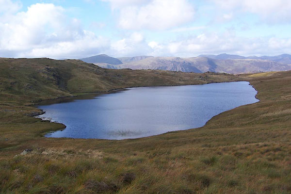 BRP68.jpg (taken 23.9.2009) 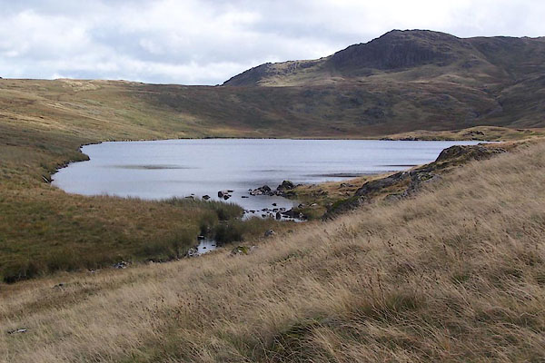 BRP69.jpg Bleatarn Gill in the foreground; Standing Crags behind. (taken 23.9.2009) |
||
|
|
||
| evidence:- | old map:- Otley 1818 |
|
| source data:- | Map, uncoloured engraving, The District of the Lakes,
Cumberland, Westmorland, and Lancashire, scale about 4 miles to
1 inch, by Jonathan Otley, 1818, engraved by J and G Menzies,
Edinburgh, Scotland, published by Jonathan Otley, Keswick,
Cumberland, et al, 1833.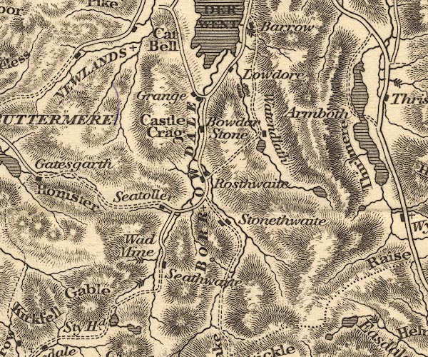 OT02NY21.jpg item:- JandMN : 48.1 Image © see bottom of page |
|
|
|
||
| evidence:- | descriptive text:- Otley 1823 (5th edn 1834) item:- fishing; trout |
|
| source data:- | Guide book, A Concise Description of the English Lakes, the
mountains in their vicinity, and the roads by which they may be
visited, with remarks on the mineralogy and geology of the
district, by Jonathan Otley, published by the author, Keswick,
Cumberland now Cumbria, by J Richardson, London, and by Arthur
Foster, Kirkby Lonsdale, Cumbria, 1823; published 1823-49,
latterly as the Descriptive Guide to the English Lakes. goto source Page 37:- "A second Blea Tarn, containing excellent trout, is situated on the heathy mountain between Wythburn and Borrowdale. After a course of nearly two miles, the water is received by Watendleth Tarn, ..." |
|
|
|
||
| evidence:- | old map:- Garnett 1850s-60s H placename:- Blea Tarn |
|
| source data:- | Map of the English Lakes, in Cumberland, Westmorland and
Lancashire, scale about 3.5 miles to 1 inch, published by John
Garnett, Windermere, Westmorland, 1850s-60s.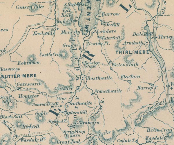 GAR2NY21.jpg "Blea Tarn" outline with shore form lines, lake or tarn item:- JandMN : 82.1 Image © see bottom of page |
|
|
|
||
| evidence:- | outline view:- Jenkinson 1875 placename:- Blea Tarn |
|
| source data:- | Print, lithograph, outline view, Panoramic Sketches from Helvellyn, Westmorland, by
Edwin A Pettitt, London, published by Edward Stanford, 55 Charing Cross, London, 1875. click to enlarge click to enlargeJk01E1.jpg "... Blea Tarn ..." item:- JandMN : 28.5 Image © see bottom of page |
|
|
|
||
Lakes Guides menu.