 Old Cumbria Gazetteer
 |
 |
|
| Beckstones, Above Derwent | ||
| Beckstones | ||
| civil parish:- | Above Derwent (formerly Cumberland) | |
| county:- | Cumbria | |
| locality type:- | buildings | |
| coordinates:- | NY21972630 | |
| 1Km square:- | NY2126 | |
| 10Km square:- | NY22 | |
|
|
||
| evidence:- | old map:- OS County Series (Cmd 55 16) placename:- Beckstones |
|
| source data:- | Maps, County Series maps of Great Britain, scales 6 and 25
inches to 1 mile, published by the Ordnance Survey, Southampton,
Hampshire, from about 1863 to 1948. |
|
|
|
||
| evidence:- | old map:- Crosthwaite 1783-94 (Bas) placename:- Beckstones |
|
| source data:- | Map, uncoloured engraving, An Accurate Map of Broadwater or
Bassenthwaite Lake, scale about 3 inches to 1 mile, by Peter
Crosthwaite, Keswick, Cumberland, 1783, version published 1800.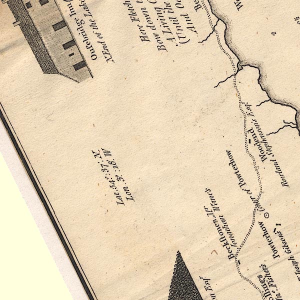 CT6NY22D.jpg "Beckstones / Mr Jonathan Wane's" item:- Armitt Library : 1959.191.4 Image © see bottom of page |
|
|
|
||
| evidence:- | probably old text:- Clarke 1787 placename:- Beck Sands |
|
| source data:- | Guide book, A Survey of the Lakes of Cumberland, Westmorland,
and Lancashire, written and published by James Clarke, Penrith,
Cumberland, and in London etc, 1787; published 1787-93. goto source goto sourcePage 92:- "... at Beck Sands, see a very rugged barren mountain on the left, ... on the right is Powter-How, ..." |
|
|
|
||
| evidence:- | old map:- Clarke 1787 map (Bassenthwaite Lake) placename:- Becksands |
|
| source data:- | Map, A Map of Broadwater and its Environs, ie Bassenthwaite
Lake, scale about 6.5 ins to 1 mile, by James Clarke, engraved
by Neele, 352 Strand, published by James Clarke, Penrith,
Cumberland and in London etc, 1787.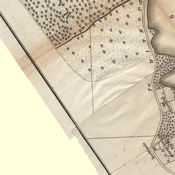 CL8NY22D.jpg "Becksands" item:- private collection : 10.8 Image © see bottom of page |
|
|
|
||
Lakes Guides menu.