 Old Cumbria Gazetteer
 |
 |
|
| Barkhouse, Setmurthy | ||
| Barkhouse | ||
| locality:- | Ruddings | |
| civil parish:- | Setmurthy (formerly Cumberland) | |
| county:- | Cumbria | |
| locality type:- | buildings | |
| coordinates:- | NY19583199 | |
| 1Km square:- | NY1932 | |
| 10Km square:- | NY13 | |
|
|
||
| evidence:- | old map:- OS County Series (Cmd 46 15) placename:- Low Ruddings placename:- Ruddings, Low |
|
| source data:- | Maps, County Series maps of Great Britain, scales 6 and 25
inches to 1 mile, published by the Ordnance Survey, Southampton,
Hampshire, from about 1863 to 1948. |
|
|
|
||
| evidence:- | old map:- Ogilby 1675 (plate 96) placename:- Lowbarcus |
|
| source data:- | Road strip map, hand coloured engraving, the Road from Kendal to
Cockermouth, and the Road from Egremond to Carlisle, scale about
1 inch to 1 mile, by John Ogilby, London, 1675.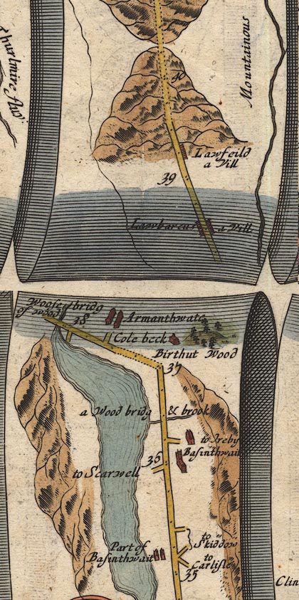 OG96m035.jpg In mile 38, Cumberland. "Lowbarcus a Vill" houses each side of the road. item:- JandMN : 22 Image © see bottom of page |
|
|
|
||
| evidence:- | old map:- Bowen 1720 (plate 261) placename:- Laubercus placename:- Barkhouse, Low |
|
| source data:- | Road strip map, uncoloured engraving, pl.261, the end of the
road from Kendal to Cockermouth and the road from Egremont to
Carlisle, scale about 2 miles to 1 inch, published by Emanuel
Bowen, St Katherines, London, 1720.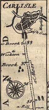 B261m35.jpg "Laubercus a Village" Before mile 39. item:- Dove Cottage : Lowther.36 Image © see bottom of page |
|
|
|
||
| evidence:- | probably old map:- Bowen and Kitchin 1760 placename:- Laubereus |
|
| source data:- | Map, hand coloured engraving, A New Map of the Counties of
Cumberland and Westmoreland Divided into their Respective Wards,
scale about 4 miles to 1 inch, by Emanuel Bowen and Thomas
Kitchin et al, published by T Bowles, Robert Sayer, and John
Bowles, London, 1760. BO18NY12.jpg "Laubereus" circle, tower item:- Armitt Library : 2008.14.10 Image © see bottom of page |
|
|
|
||
| evidence:- | probably old map:- Donald 1774 (Cmd) placename:- Park Houses |
|
| source data:- | Map, hand coloured engraving, 3x2 sheets, The County of Cumberland, scale about 1
inch to 1 mile, by Thomas Donald, engraved and published by Joseph Hodskinson, 29
Arundel Street, Strand, London, 1774.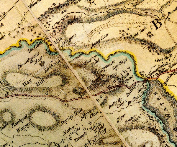 D4NY13SE.jpg "Park Houses" block or blocks, labelled in lowercase; a hamlet or just a house item:- Carlisle Library : Map 2 Image © Carlisle Library |
|
|
|
||
| evidence:- | old map:- Crosthwaite 1783-94 (Bas) placename:- Low Rudding |
|
| source data:- | Map, uncoloured engraving, An Accurate Map of Broadwater or
Bassenthwaite Lake, scale about 3 inches to 1 mile, by Peter
Crosthwaite, Keswick, Cumberland, 1783, version published 1800.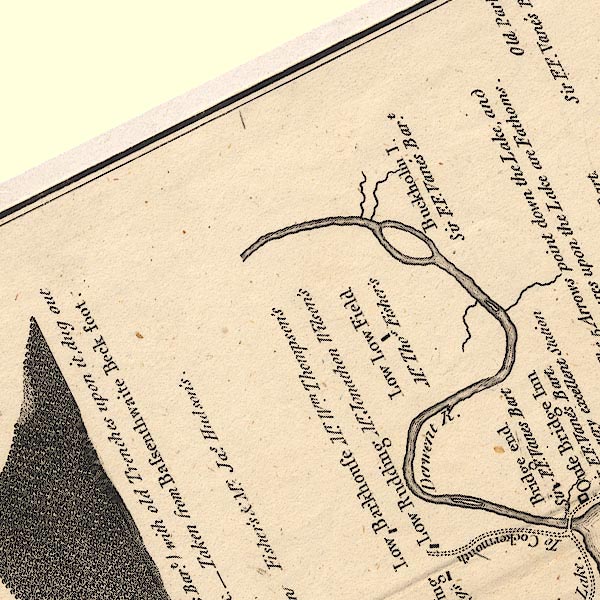 CT6NY13W.jpg "Low Rudding / Mr. Jonathon Wilson's" item:- Armitt Library : 1959.191.4 Image © see bottom of page |
|
|
|
||
 Lakes Guides menu.