 Old Cumbria Gazetteer
 |
 |
|
| bridge, St John's Castlerigg etc (5) | ||
| suggested | ||
| civil parish:- | St John's Castlerigg and Wythburn (formerly Cumberland) | |
| county:- | Cumbria | |
| locality type:- | bridge | |
| coordinates:- | NY29872445 (guess) | |
| 1Km square:- | NY2924 | |
| 10Km square:- | NY22 | |
| SummaryText:- | no stream here? | |
| references:- | Bell 1892 |
|
|
|
||
| evidence:- | old map:- Bell 1892 placename:- Langton Moss Bridge |
|
| source data:- | Map, colour lithograph, Road Map of Cumberland, by George Joseph
Bell, scale about 2.5 miles to 1 inch, printed by Charles
Thurnam and Sons, Carlisle, Cumberland, 1892.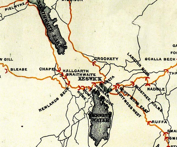 BEL9NY22.jpg "LANGTON MOSS" bridge symbol Road map of Cumberland showing County Bridges item:- Carlisle Library : Map 38 Image © Carlisle Library |
|
|
|
||
 Lakes Guides menu.