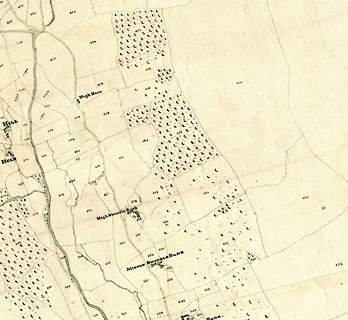


 High Swinklebank, Longsleddale
placename:- High Swindle Bank
Schedule, each row gives:-
Field no. / Tenant's name / Close ie Field name / Type of culture / Area, acres
Owned by Robert Walker, tenanted by John Walker; High Swindle Bank. "/ / Walker Robert"
"/ 500 / John Walker / Cragg / Pas / 64 125"
"/ 505 / Do / Far Field / Pas / 5 755"
"/ 506 / Do / Far Wood / Pas / 4 715"
"/ 507 / Do / Do / Wood / 1 925"
"/ 508 / Do / Plantation / / 14 650"
"/ 509 / Do / Grubbing / Pas / 2 970"
"/ 510 / Do / Field End / Ar &Mea / 8 175"
"/ 511 / Do / Stubbings / Mea / 5 680"
"/ 514 / Do / Plantation / / 0 745"
"/ 515 / Do / High Stewart Ing / Mea. / 6 650"
"/ 516 / Do / Plantation / / 0 230"
"/ 517 / Do / Towinghowe Hill / Ar &Mea / 1 685"
"/ 520 / Do / Low Field / Ar &Mea / 2 925"
"/ 521 / Do / High Field / Mea. / 2 025"
"/ 522 / Do / Orchard &Garden / / 0 340"
"/ 523 / Do / Homstd. &c at High Swindle Bank / / 0 440"
"/ 524 / Do / Parrock / Pas / 0 530"
"/ 525 / Do / Old Parrock / Pas / 4 485"
"/ 525a / Do / Plantation / / 0 035"
"/ 526 / Do / Old Parrock / Pas / 5 230"
"/ 527 / Do / Low Wood / / 10 110"
"/ 554 / ¼part Do of / Grassing Heads / Pas / 26 080"
"/ / / / / [total] 169 505"
""
 click to enlarge
CRny4904.jpg
map courtesy of Mark Cropper
item:- private collection : 370
Image © see bottom of page
placename:- High Swindle Bank
"Walker Robert / John Walker / High Swindle Bank / 169 505 169 2 1 / ..."
