 Old Cumbria Gazetteer
 |
 |
|
| viewpoint, Morecambe | ||
| locality:- | Morecambe | |
| county:- | Lancashire | |
| locality type:- | viewpoint | |
| locality type:- | outline view | |
| coordinates:- | SD43906477 | |
| 1Km square:- | SD4364 | |
| 10Km square:- | SD46 | |
|
|
||
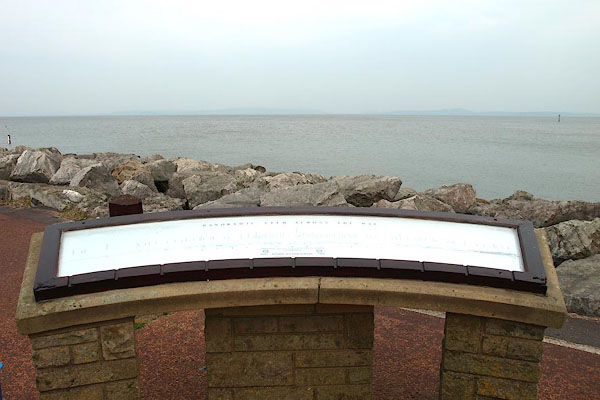 BQL15.jpg It's labelled:- "PANORAMIC VIEW ACROSS THE BAY" It was out bad luck that the view was gone! (taken 24.4.2009) 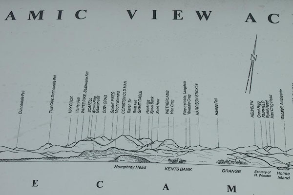 BQL16.jpg Detail of the outline view: Coniston Fells, Wetherlam, Helvellyn, etc; Humphrey Head, Kents Bank and Grange-over-Sands. (taken 24.4.2009) |
||
|
|
||
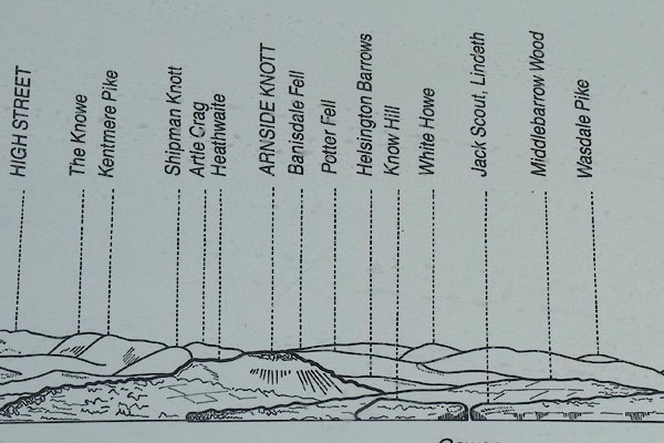 BQL17.jpg Detail of the outline view: High Street, The Knowe, Kentmere Pike, Shipman Knotts, Artle Crag, Heathwaite, Arnside Knott, Bannisdale Fell, Potter Fell, Helsington Barrows, Know Hill, White Howe, Jack Scout, Wasdale Pike. (taken 24.4.2009) 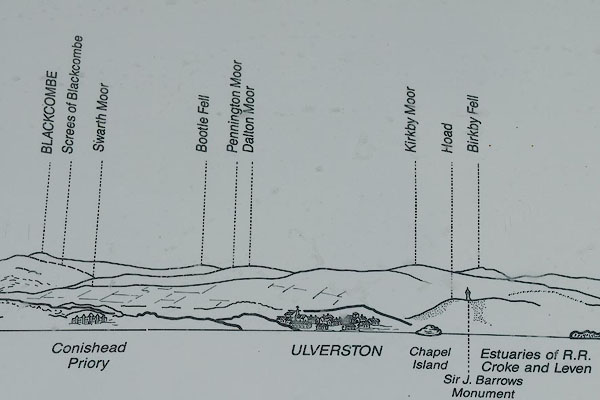 BQL18.jpg Detail of the outline view: Black Combe, Swarth Moor, Conishead Priory, Bootle Fell, Pennington Moor, Dalton Moor, Ulverston, Kirkby Moor, Chapel Island, Hoad Hill, Sir John Barrow Monument, Birkby Fell. (taken 24.4.2009) |
||
|
|
||
| hearsay:- |
Originally provided by the Rotary Club of Morecambe and Heysham, celebrating their
jubilee, 1905-55. Refurbished by Lancaster City Council, 1984. |
|
|
|
||
 Lakes Guides menu.