 Old Cumbria Gazetteer
 |
 |
|
| Quarry Cottage, Longsleddale | ||
| Quarry Cottage | ||
| locality:- | Wads Howe | |
| locality:- | Spring Wood | |
| civil parish:- | Longsleddale (formerly Westmorland) | |
| county:- | Cumbria | |
| locality type:- | buildings (ruin) | |
| coordinates:- | NY49290295 | |
| 1Km square:- | NY4902 | |
| 10Km square:- | NY40 | |
| references:- | OS County Series |
|
|
|
||
| evidence:- | old map:- KendalRO : WD/Rig/Acc.1296/49 |
|
| source data:- | Estate plan, hand coloured lithograph, Plan of Well Foot and Hollin Root Estates,
and Sleddale Forest, Longsleddale, Westmorland, by J Bintley, printed by R Robinson,
Nottingham, Nottinghamshire, 1859. "QUARRY [CO.]" |
|
|
|
||
| evidence:- | old map:- Kendal Corn Rent Act 1836 |
|
| source data:- | Tithe map, Plan of part of the Township of Longsleddale, Westmorland, made regarding
the Kendal Corn Rent Act, ie a tithe award map, scale about 20 inches to 1 mile, Kendal,
Westmorland, 1836.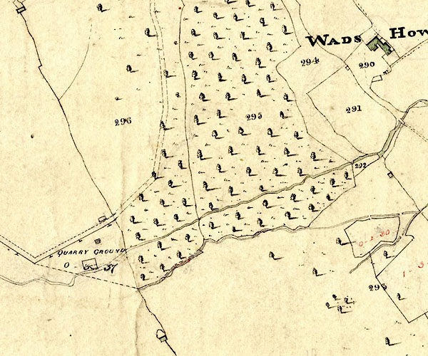 KCR217.jpg courtesy of Mark Cropper Plan of part of the Township of Longsleddale, Westmorland, made regarding the Kendal Corn Rent Act, ie a tithe award map, scale about 20 inches to 1 mile, Kendal, Westmorland, 1836. "QUARRY GROUND" Quarry Cottage is the building north of Quarry Ground item:- private collection : 370 Image © see bottom of page |
|
|
|
||
 Lakes Guides menu.