 Old Cumbria Gazetteer
 |
 |
|
| Beech Hill Bridge, Longsleddale | ||
| Beech Hill Bridge | ||
| site name:- | Sprint, River | |
| locality:- | Beech Hill | |
| civil parish:- | Longsleddale (formerly Westmorland) | |
| county:- | Cumbria | |
| locality type:- | bridge | |
| locality type:- | flood | |
| coordinates:- | NY50120280 | |
| 1Km square:- | NY5002 | |
| 10Km square:- | NY50 | |
|
|
||
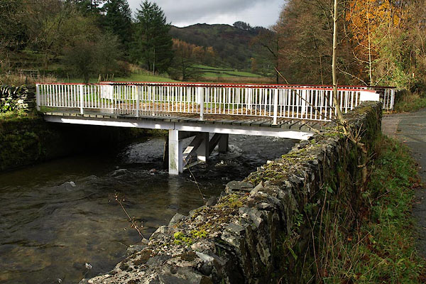 BRW89.jpg (taken 17.11.2009) |
||
|
|
||
| evidence:- | old map:- OS County Series (Wmd 27 11,12) |
|
| source data:- | Maps, County Series maps of Great Britain, scales 6 and 25
inches to 1 mile, published by the Ordnance Survey, Southampton,
Hampshire, from about 1863 to 1948.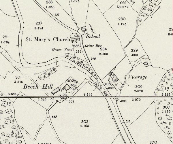 C5E015.jpg |
|
|
|
||
| evidence:- | old map:- Hodgson 1828 |
|
| source data:- | Map, hand coloured engraving, 4 sheets mounted together on linen and rolled, Plan
of the County of Westmorland, scale about 1.25 inches to 1 mile, by Thomas Hodgson,
engraved by W R Gardner, Harpur Street, London, published by Thomas Hodgson, Lancaster,
and perhaps by C Smith, 172 Strand, London,1828.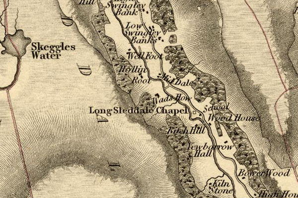 HDG6lsl2.jpg map courtesy of Mark Cropper item:- private collection : 371 Image © see bottom of page |
|
|
|
||
| evidence:- | old map:- OS 1881-82 New Series (outline edition) |
|
| source data:- | Map, engraving, area north of Kendal, Westmorland, New Series
one inch map, outline edition, sheet 39, scale 1 inch to 1 mile,
published by the Ordnance Survey, Southampton, Hampshire,
1881-82.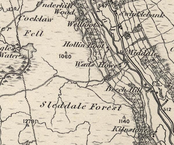 O21NY40W.jpg , item:- JandMN : 61 Image © see bottom of page |
|
|
|
||
| evidence:- | records:- Curwen 1926 placename:- Bitch Hill Bridge |
|
| source data:- | Records Relating to the Barony of Kendale, supplementary vol.3,
edited by John F Curwen, published by Titus Wilson and Son,
Kendal, Westmorland, 1926. CURWEN01.txt "1699 July 14 : Order that Will. Holme, Margaret Todd, Roger Lickbarrow, John Lowes and Isabel Harryson repair a foot bridge in Long Sleddale called Bitch Hill Bridge (now Beech Hill). Kendal Order Book, 1696-1724." "..." "1729/30 January 16 : Order that the Rev. Mr. Trent pay £2 9s. to John Gibson, Isaac Goodman, Alice Collinson and Will. Holme, being his proportionable rate towards the charge of erecting a stone bridge called Bitch-hill bridge in Long Sleddale. K. Order Book, 1724-1737." |
|
|
|
||
| evidence:- | records:- KendalRO : QS AR/2/13/3 215/23 placename:- Bitch Hill Bridge item:- flood, 1750 |
|
| source data:- | Summary from Quarter Session Rolls; Kendal Easter Sessions Roll 1750 Petition, Isaac Goodman, Mary Gibson, Alice Collinson, Anthony Kellet &James Garnet of Longsleddale, that Bitch-hill-Bridge was by the Rapidity of the River in or ab[out] August last intirely destroyed and they have also suffered by the floods about the same time and cannot rebuild bridge without assistance. Rejected |
|
|
|
||
| evidence:- | map:- OS Six Inch (1956) |
|
| source data:- | Map series, various editions with the national grid, scale about
6 inches to 1 mile, published by the Ordnance Survey,
Southampton, Hampshire, scale 1 to 10560 from 1950s to 1960s,
then 1 to 10000 from 1960s to 2000s, superseded by print on
demand from digital data.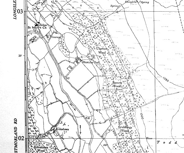 SINY5002.jpg |
|
|
|
||
 Lakes Guides menu.