 |
 |
|
|
|
|
Scalegill |
| civil parish:- |
Egremont (formerly Cumberland) |
| county:- |
Cumbria |
| locality type:- |
locality |
| locality type:- |
buildings |
| coordinates:- |
NX99861428 (etc) |
| 1Km square:- |
NX9914 |
| 10Km square:- |
NX91 |
|
|
| evidence:- |
old map:- OS County Series (Cmd 67 15)
placename:- Scalegill Place
|
| source data:- |
Maps, County Series maps of Great Britain, scales 6 and 25
inches to 1 mile, published by the Ordnance Survey, Southampton,
Hampshire, from about 1863 to 1948.
""
|
|
|
| places:- |
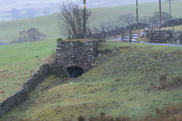 |
NY58980594 limekiln, Orton S (7) (Orton S) |
|
|
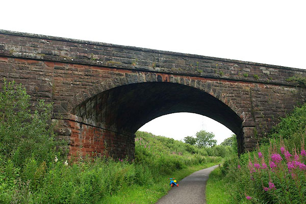 |
NX99861436 railway bridge, Egremont (3) (Egremont) |
|

 Lakes Guides menu.