 Old Cumbria Gazetteer
 |
 |
|
| Grizedale Moor, Satterthwaite | ||
| Grizedale Moor | ||
| site name:- | Grizedale Moor | |
| civil parish:- | Satterthwaite (formerly Lancashire) | |
| civil parish:- | Claife (formerly Lancashire) | |
| county:- | Cumbria | |
| locality type:- | moor | |
| coordinates:- | SD32889611 (etc) | |
| 1Km square:- | SD3296 | |
| 10Km square:- | SD39 | |
|
|
||
| evidence:- | old map:- OS County Series (Lan 5 5) placename:- Grizedale Moor |
|
| source data:- | Maps, County Series maps of Great Britain, scales 6 and 25
inches to 1 mile, published by the Ordnance Survey, Southampton,
Hampshire, from about 1863 to 1948. |
|
|
|
||
| evidence:- | possibly old drawing:- Aspland 1840s-60s |
|
| source data:- | Drawing, pencil, Grizedale Moor? Satterthwaite and Claife, Lancashire, by Theophilus
Lindsey Aspland, 31 August 1869.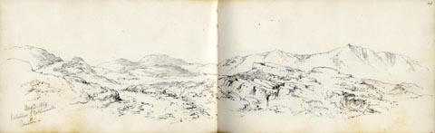 click to enlarge click to enlargeAS0650.jpg "Aug 31. 1869. / between Esthwaite / & / Coniston." page number "43" item:- Armitt Library : 2008.61.50 Image © see bottom of page |
|
|
|
||
| evidence:- | perhaps old drawing:- Aspland 1840s-60s |
|
| source data:- | Drawing, pencil, perhaps Grizedale Moor, Satterthwaite and Claife, Lancashire, by
Theophilus Lindsey Aspland, 1869.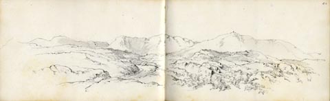 click to enlarge click to enlargeAS0651.jpg page number "44" item:- Armitt Library : 2008.61.51 Image © see bottom of page |
|
|
|
||
 Lakes Guides menu.