 Old Cumbria Gazetteer
 |
 |
|
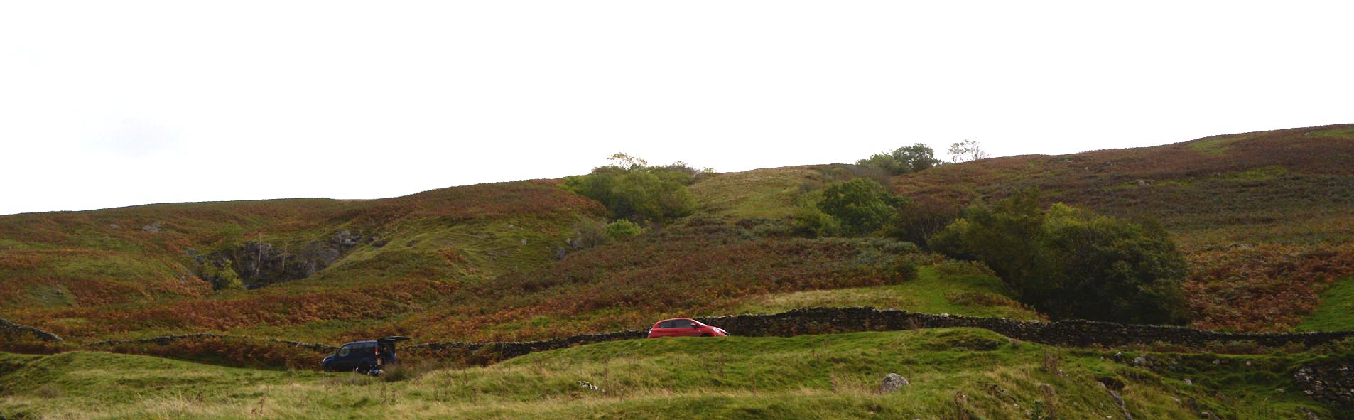
| Three Gills, Barbondale | ||
| Three Gills | ||
| locality:- | Barbondale | |
| civil parish:- | Barbon (formerly Westmorland) | |
| county:- | Cumbria | |
| locality type:- | locality | |
| coordinates:- | SD66538406 (etc) | |
| 1Km square:- | SD6684 | |
| 10Km square:- | SD68 | |
|
|
||
 Click to enlarge CGQ05.jpg (taken 29.9.2017) |
||
|
|
||
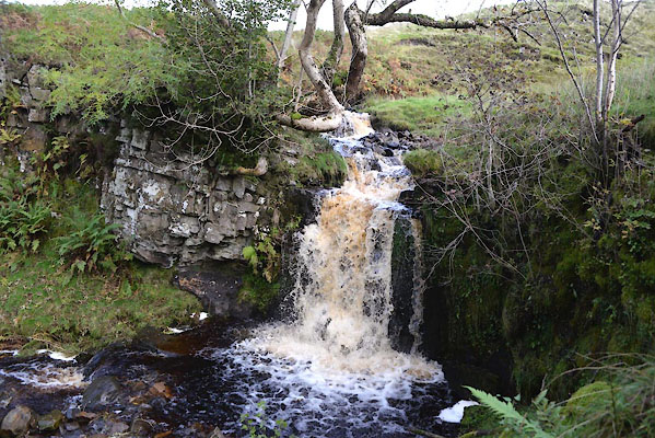
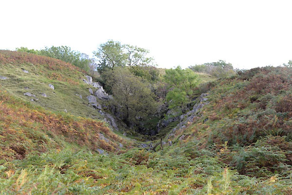
| The Low Gill at Three Gills |
||
| Notes made 29 September 2017. The beck which runs off the fell at the top was fairly
full:- |
||
 CGQ09.jpg (taken 29.9.2017) 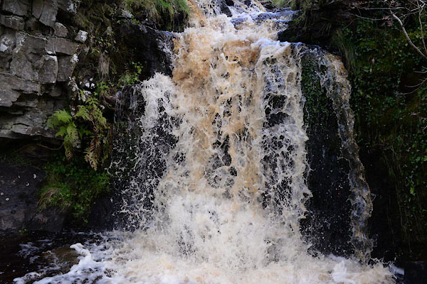 CGQ10.jpg (taken 29.9.2017) |
||
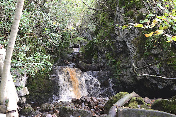
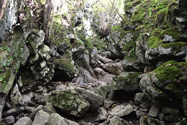
| Immediately below the beck falls agin into a deep chasm. The chasm appears to have
been formed by cavern collapse; very steep rocky sides, heavily wooded. |
||
 CGQ11.jpg (taken 29.9.2017) 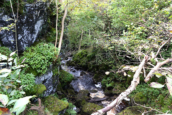 CGQ12.jpg (taken 29.9.2017) |
||
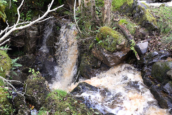
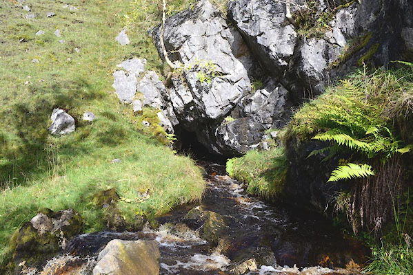
| Much further down it is possible to get into the chasm from the side. The water flow
here was less than at the top, some having been swallowed in sink holes, and more
was flowing away into the surrounding rock at this spot. |
||
 CGQ14.jpg (taken 29.9.2017) 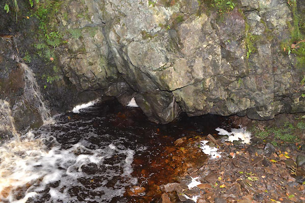 CGQ13.jpg Water flowing off to the beck's left side, south. (taken 29.9.2017) 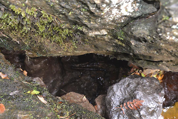 CGQ15.jpg Water flowing down into a hole on the beck's right side, north. (taken 29.9.2017) 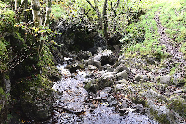 CGQ16.jpg Beck below this spot. (taken 29.9.2017) |
||
| Holy Tree Sink is probably just below this point. |
||
| An attempt was made to walk up the beck from the bottom of the chasm, which was dry.
This is gill scrambling without the water! |
||
 CGQ18.jpg The stream bed at (taken 29.9.2017) 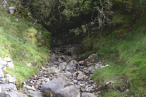 CGQ17.jpg The stream bed at the foot of the chasm, (taken 29.9.2017) 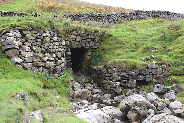 CGQ07.jpg The culvert for the low gill under the road. (taken 29.9.2017) |
||
| I was unable to scramble up to the position of Holly Tree Sink, SD66648400, which
is possibly where nearly all the water goes underground. |
||
|
|
||
| MN photo:- |
The Middle Gill at Three Gills |
|
 CGQ19.jpg (taken 29.9.2017) |
||
|
|
||
| The upper beck |
||
| "" |
||
 CGQ23.jpg The head of the beck, this is presumably Crystal Cave labelled on maps. (taken 29.9.2017) 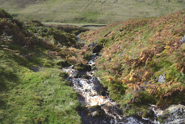 CGQ26.jpg View down the gill. (taken 29.9.2017) 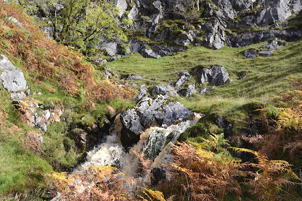 CGQ21.jpg Waterfall at (taken 29.9.2017) 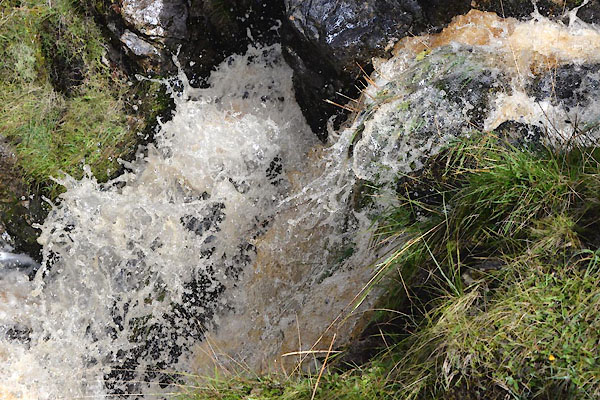 CGQ22.jpg Waterfall at (taken 29.9.2017) 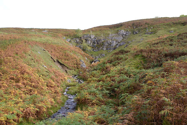 CGQ20.jpg (taken 29.9.2017) |
||
|
|
||
| notes:- |
Three gills together and, on the map, a lot of interesting features: Crystal Cave,
Dog Hole, Barkin Cave, Holly Tree Sink, and waterfalls. The caves and swallow holes
are not easy to find. The low gill is in a deep glen with near vertical sides. The
bed might be dry but 'gill scrambling' up it is for the fit! The high gill is bordered
by head high bracken. |
|
|
|
||
| see:- |  Crystal Cave, Barbondale Crystal Cave, Barbondale |
|
|
|
||
| see:- | Dog Hole, Barbondale |
|
|
|
||
Lakes Guides menu.