 Old Cumbria Gazetteer
 |
 |
|
| mill, Meal Bank (3) | ||
| gone? | ||
| site name:- | Mint, River | |
| locality:- | Meal Bank | |
| civil parish:- | Scalthwaiterigg (formerly Westmorland) | |
| county:- | Cumbria | |
| locality type:- | water mill | |
| locality type:- | mill | |
| locality type:- | snuff mill | |
| coordinates:- | SD54079566 | |
| 1Km square:- | SD5495 | |
| 10Km square:- | SD59 | |
|
|
||
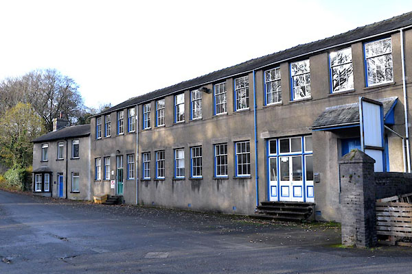 CGW25.jpg Present buildings. (taken 10.11.2017) 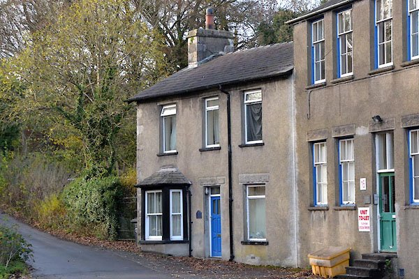 CGW26.jpg Mill House. (taken 10.11.2017) |
||
|
|
||
| evidence:- | old map:- OS County Series (Wmd 34 13) |
|
| source data:- | Maps, County Series maps of Great Britain, scales 6 and 25
inches to 1 mile, published by the Ordnance Survey, Southampton,
Hampshire, from about 1863 to 1948. "Snuff Mill" |
|
|
|
||
| notes:- |
group of mills. Described by Somervell. |
|
| Somervell, John: 1930: Water Power Mills of South Westmorland |
||
|
|
||
 Lakes Guides menu.