 Old Cumbria Gazetteer
 |
 |
|
| Lodge, Rockcliffe | ||
| Lodge | ||
| locality:- | Castletown House | |
| civil parish:- | Rockcliffe (formerly Cumberland) | |
| county:- | Cumbria | |
| locality type:- | buildings | |
| coordinates:- | NY35056214 | |
| 1Km square:- | NY3562 | |
| 10Km square:- | NY36 | |
|
|
||
 CEN80.jpg (taken 6.2.2016) 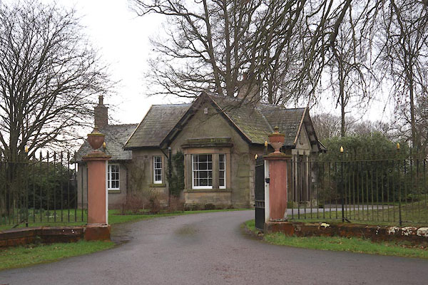 CEN79.jpg (taken 6.2.2016) |
||
|
|
||
| evidence:- | old map:- OS County Series (Cmd 16 5) placename:- Lodge |
|
| source data:- | Maps, County Series maps of Great Britain, scales 6 and 25
inches to 1 mile, published by the Ordnance Survey, Southampton,
Hampshire, from about 1863 to 1948. |
|
|
|
||
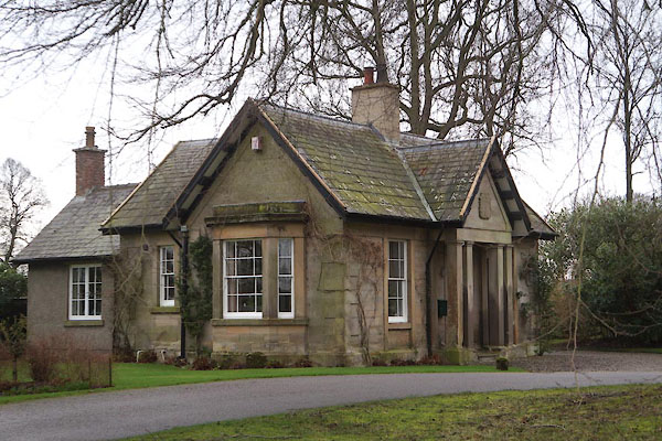
| evidence:- | database:- Listed Buildings 2010 placename:- Castletown |
|
| source data:- | courtesy of English Heritage "LODGE TO EAST OF CASTLETOWN / / / ROCKCLIFFE / CARLISLE / CUMBRIA / II / 77947 / NY3505262143" |
|
| source data:- | courtesy of English Heritage "Lodge to Castletown. Probably 1811, same date as house. Calciferous sandstone ashlar with chamfered plinth and large flush quoins; graduated slate roof, ashlar chimney stacks. Single storey, 2 bays. Tetrastyle pedimented portico has squared columns with moulded entablature and carved arms of Mounsey family. 4-panel door with glazed fanlight. Sash windows with glazing bars, have pilaster strip surrounds." |
|
|
|
||
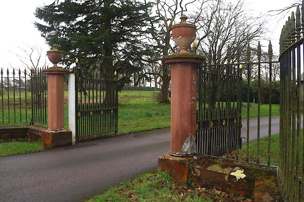
| evidence:- | database:- Listed Buildings 2010 |
|
| source data:- | courtesy of English Heritage "GATES, PIERS AND WALLS EAST OF CASTLETOWN / / / ROCKCLIFFE / CARLISLE / CUMBRIA / II / 77948 / NY3506662171" |
|
| source data:- | courtesy of English Heritage "Gates, piers and walls to Castletown. Probably 1811, same date as house. 6 octagonal painted stone piers with vase finials, joined by serpentine shaped low red sandstone wall. Cast-iron gates with spear railings are reset with C20 steel pillars behind existing piers. Included for group value." |
|
|
|
||
 CEN81.jpg (taken 6.2.2016) 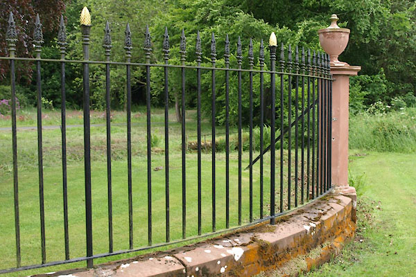 BWT73.jpg Railings. (taken 15.6.2012) 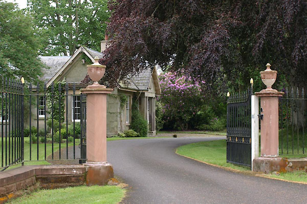 BWT72.jpg (taken 15.6.2012) |
||
|
|
||
 Lakes Guides menu.