 Old Cumbria Gazetteer
 |
 |
|
| Little Gatesgarth Dale, Borrowdale | ||
| Little Gatesgarth Dale | ||
| locality:- | Seatoller Fell | |
| locality:- | Hause Gill | |
| civil parish:- | Borrowdale (formerly Cumberland) | |
| county:- | Cumbria | |
| locality type:- | valley | |
| coordinates:- | NY23381361 (etc) | |
| 1Km square:- | NY2313 | |
| 10Km square:- | NY21 | |
|
|
||
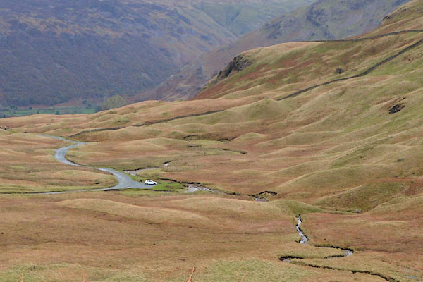 CGV52.jpg Drumlins? (taken 3.11.2917) |
||
|
|
||
| evidence:- | old map:- OS County Series (Cmd 70 13) placename:- Little Gatesgarth Dale placename:- Gatesgarth Dale, Little |
|
| source data:- | Maps, County Series maps of Great Britain, scales 6 and 25
inches to 1 mile, published by the Ordnance Survey, Southampton,
Hampshire, from about 1863 to 1948. |
|
|
|
||
 Lakes Guides menu.