 Old Cumbria Gazetteer
 |
 |
|
| Holehead, Bewcastle | ||
| Holehead | ||
| civil parish:- | Bewcastle (formerly Cumberland) | |
| county:- | Cumbria | |
| locality type:- | buildings | |
| coordinates:- | NY52277841 | |
| 1Km square:- | NY5278 | |
| 10Km square:- | NY57 | |
|
|
||
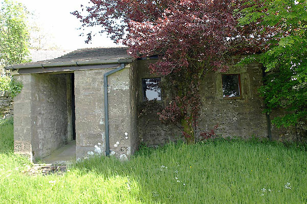 BSW22.jpg (taken 4.6.2010) 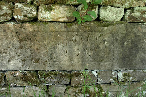 BSW23.jpg Plaque in the garden wall:- "SCHOOL / 1827" (taken 4.6.2010) |
||
|
|
||
| evidence:- | old map:- OS County Series (Cmd 3 12) placename:- Holehead |
|
| source data:- | Maps, County Series maps of Great Britain, scales 6 and 25
inches to 1 mile, published by the Ordnance Survey, Southampton,
Hampshire, from about 1863 to 1948. |
|
|
|
||
 Lakes Guides menu.