 Old Cumbria Gazetteer
 |
 |
|
| Crosses Farm, Windermere | ||
| Crosses Farm | ||
| locality:- | Crosses | |
| civil parish:- | Windermere (formerly Westmorland) | |
| county:- | Cumbria | |
| locality type:- | buildings | |
| coordinates:- | NY41090009 | |
| 1Km square:- | NY4100 | |
| 10Km square:- | NY40 | |
|
|
||
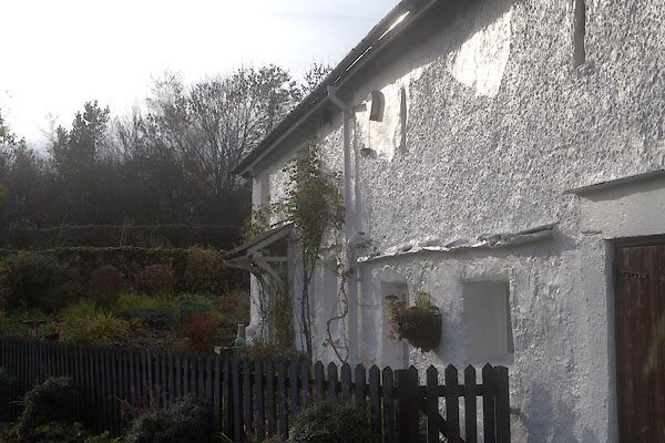 CFS04.jpg (taken 11.11.2016) 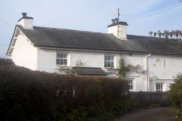 CFS05.jpg (taken 11.11.2016) |
||
|
|
||
| evidence:- | hearth tax returns:- Hearth Tax 1675 placename:- Crosses |
|
| source data:- | Records, hearth tax survey returns, Westmorland, 1674/75. "Crosses" in "Applethwaite" |
|
|
|
||
| evidence:- | perhaps old map:- Ogilby 1675 (plate 96) placename:- Grosgate |
|
| source data:- | Road strip map, hand coloured engraving, the Road from Kendal to
Cockermouth, and the Road from Egremond to Carlisle, scale about
1 inch to 1 mile, by John Ogilby, London, 1675.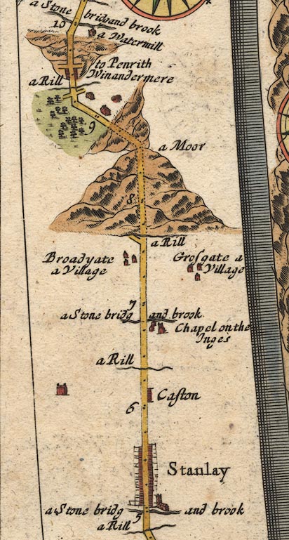 OG96m005.jpg In mile 9, Westmoreland. Houses on the right of the road. item:- JandMN : 22 Image © see bottom of page |
|
|
|
||
| evidence:- | old map:- Jefferys 1770 (Wmd) placename:- Crosses |
|
| source data:- | Map, 4 sheets, The County of Westmoreland, scale 1 inch to 1
mile, surveyed 1768, and engraved and published by Thomas
Jefferys, London, 1770.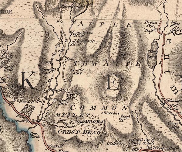 J5NY40SW.jpg "Crosses" circle, labelled in italic lowercase text; settlement, farm, house, or hamlet? item:- National Library of Scotland : EME.s.47 Image © National Library of Scotland |
|
|
|
||
| evidence:- | database:- Listed Buildings 2010 placename:- Crosses, The |
|
| source data:- | courtesy of English Heritage "THE CROSSES / / / WINDERMERE TOWN / SOUTH LAKELAND / CUMBRIA / II / 351650 / NY4109500086" |
|
|
|
||
 Lakes Guides menu.