 Old Cumbria Gazetteer
 |
 |
|
| toll gate, Cockermouth | ||
| once? | ||
| Street:- | Kirkgate | |
| locality:- | Cockermouth | |
| civil parish:- | Cockermouth (formerly Cumberland) | |
| county:- | Cumbria | |
| locality type:- | toll gate (site) | |
| coordinates:- | NY12423049 (about) | |
| 1Km square:- | NY1230 | |
| 10Km square:- | NY13 | |
|
|
||
| evidence:- | old map:- Donald 1774 (Cmd) |
|
| source data:- | Map, hand coloured engraving, 3x2 sheets, The County of Cumberland, scale about 1
inch to 1 mile, by Thomas Donald, engraved and published by Joseph Hodskinson, 29
Arundel Street, Strand, London, 1774.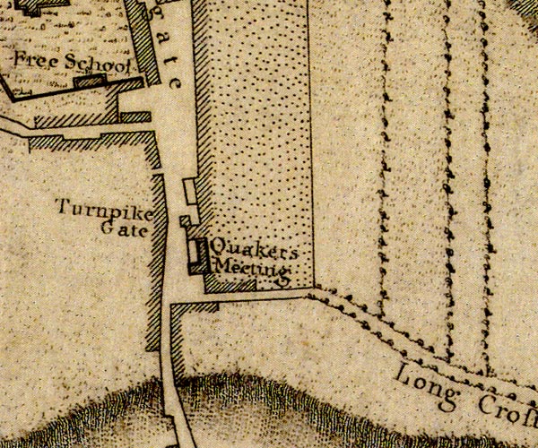 D41230M.jpg "Turnpike Gate" perhaps a toll house item:- Carlisle Library : Map 2 Image © Carlisle Library |
|
|
|
||
 Act of Parliament Act of Parliament |
||
|
|
||
| notes:- |
Reading backwards from the mile marks on Greenwood's county map, 1824, this is about
where the count of road distances starts. |
|
| Greenwood 1824 |
||
|
|
||
 Lakes Guides menu.