 Old Cumbria Gazetteer
 |
 |
|
| Thiefside Hill, Hesket | ||
| Thiefside Hill | ||
| civil parish:- | Hesket (formerly Cumberland) | |
| county:- | Cumbria | |
| locality type:- | hill | |
| locality type:- | gallows (site) | |
| coordinates:- | NY48314166 (etc) | |
| 1Km square:- | NY4841 | |
| 10Km square:- | NY44 | |
| altitude:- | 584 feet | |
| altitude:- | 178m | |
|
|
||
| evidence:- | old map:- OS County Series (Cmd 39 7) placename:- Thiefside Hill |
|
| source data:- | Maps, County Series maps of Great Britain, scales 6 and 25
inches to 1 mile, published by the Ordnance Survey, Southampton,
Hampshire, from about 1863 to 1948. |
|
|
|
||
| evidence:- | old map:- Donald 1774 (Cmd) placename:- Thiefside Fell |
|
| source data:- | Map, hand coloured engraving, 3x2 sheets, The County of Cumberland, scale about 1
inch to 1 mile, by Thomas Donald, engraved and published by Joseph Hodskinson, 29
Arundel Street, Strand, London, 1774.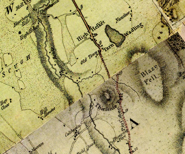 D4NY44SE.jpg "Thiefside Fell" hill hachuring; a hill or mountain item:- Carlisle Library : Map 2 Image © Carlisle Library |
|
|
|
||
| evidence:- | old text:- Harper 1907 placename:- Thiefside |
|
| source data:- | HP01p136.txt Page 136:- "... then, two miles from High Hesket, on the left hand, rises the hill known suggestively as Thiefside: the thieves in question, no doubt, the old horse-thieves, cattle-raiders, and moss-trooping vagabonds of the Border. Here, appropriately enough, Topliss, the motor-bandit, was shot dead by the police in June, 1920. ..." HP01p137.txt Page 137:- "..." 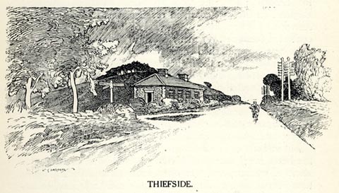 click to enlarge click to enlargeHP0121.jpg "THIEFSIDE." item:- JandMN : 1055.22 Image © see bottom of page |
|
|
|
||
| notes:- |
Here was a gallows for poachers, sheep stealers, and the like. |
|
|
|
||
 Lakes Guides menu.