 |
 |
   |
|
|
|
Strickland Ees |
| locality:- |
Esthwaite Water |
| civil parish:- |
Hawkshead (formerly Lancashire) |
| county:- |
Cumbria |
| locality type:- |
headland |
| coordinates:- |
SD35889643 (etc) |
| 1Km square:- |
SD3596 |
| 10Km square:- |
SD39 |
|
|
| evidence:- |
old map:- OS County Series (Lan 5 6)
placename:- Strickland Ees
|
| source data:- |
Maps, County Series maps of Great Britain, scales 6 and 25
inches to 1 mile, published by the Ordnance Survey, Southampton,
Hampshire, from about 1863 to 1948.
|
|
|
| evidence:- |
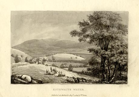
old print:- Green 1814 (plate 5)
item:- cattle
|
| source data:- |
Print, tinted soft ground etching, Esthwaite Water, Hawkshead, Lancashire, by William
Green, Ambleside, Westmorland, 1814.
 click to enlarge click to enlarge
GN1005.jpg
The 'island' is a headland, Strickland Ees.
Plate 5 in Sixty Small Prints.
printed at top right:- "5"
printed at bottom:- "ESTHWAITE WATER. / Published at Ambleside Augst. 1, 1814, by Wm. Green."
item:- Armitt Library : A6653.5
Image © see bottom of page
|
|
|
| evidence:- |
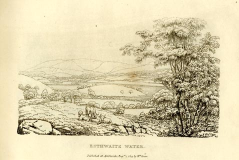
old print:- Green 1814 (plate 5)
item:- cattle
|
| source data:- |
Print, uncoloured soft ground etching, Esthwaite Water, Hawkshead, Lancashire, by
William Green, Ambleside, Westmorland, 1814.
 click to enlarge click to enlarge
GN0905.jpg
The 'island' is a headland, Strickland Ees.
Plate 5 in Sixty Small Prints.
printed at top right:- "5"
printed at bottom:- "ESTHWAITE WATER. / Published at Ambleside Augst. 1, 1814, by Wm. Green."
item:- Armitt Library : A6656.5
Image © see bottom of page
|
|
|
| evidence:- |
old text:- Green 1814
|
| source data:- |
Set of prints, soft ground etchings, Sixty Small Prints, with
text, A Description of a Series of Sixty Small Prints, by
William Green, Ambleside, Westmorland, 1814.
 goto source goto source
page 5:- "... Esthwaite Water is about two miles in length, and half a mile across. The most
striking object on its borders is the promontory at Esthwaite Hall; it shoots boldly
to the lake, which is encompassed by gentle hills. ..."
|
|
|


 click to enlarge
 click to enlarge
 goto source