| source data:- |
Maps, County Series maps of Great Britain, scales 6 and 25
inches to 1 mile, published by the Ordnance Survey, Southampton,
Hampshire, from about 1863 to 1948.
"British Settlement (Remains of) / Stones"
earthworks
|
| source data:- |
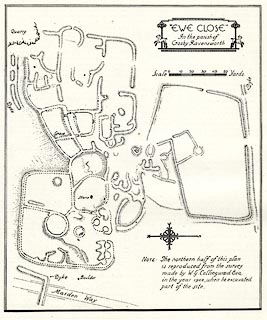
Site plan, uncoloured lithograph, Ewe Close, settlement, Crosby Ravensworth, Westmorland,
scale about 1 to 1300, published by Royal Commission on Historical Monuments England,
London, 1936.
 click to enlarge click to enlarge
HMW056.jpg
On p.84 of the Inventory of the Historical Monuments in Westmorland.
printed, upper right ""EWE CLOSE" / In the parish of / Crosby Ravensworth"
RCHME no. Wmd, Crosby Ravensworth 25
item:- Armitt Library : A745.56
Image © see bottom of page
|


 click to enlarge
 Lakes Guides menu.