 Old Cumbria Gazetteer
 |
 |
|
| Rake How, St John's Castlerigg etc | ||
| Rake How | ||
| locality:- | St John's in the Vale | |
| civil parish:- | St John's Castlerigg and Wythburn (formerly Cumberland) | |
| county:- | Cumbria | |
| locality type:- | buildings | |
| coordinates:- | NY31232216 | |
| 1Km square:- | NY3122 | |
| 10Km square:- | NY32 | |
|
|
||
| evidence:- | old map:- OS County Series (Cmd 64 8) placename:- Rake How |
|
| source data:- | Maps, County Series maps of Great Britain, scales 6 and 25
inches to 1 mile, published by the Ordnance Survey, Southampton,
Hampshire, from about 1863 to 1948. |
|
|
|
||
| evidence:- | possibly old map:- Donald 1774 (Cmd) placename:- Royal Hill |
|
| source data:- | Map, hand coloured engraving, 3x2 sheets, The County of Cumberland, scale about 1
inch to 1 mile, by Thomas Donald, engraved and published by Joseph Hodskinson, 29
Arundel Street, Strand, London, 1774.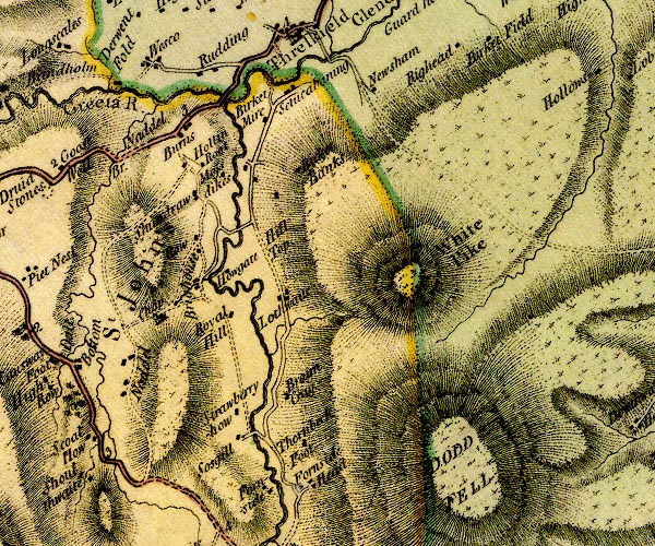 D4NY32SW.jpg "Royal Hill" block or blocks, labelled in lowercase; a hamlet or just a house item:- Carlisle Library : Map 2 Image © Carlisle Library |
|
|
|
||
| evidence:- | old painting:- Green 1790s-1820s (?) |
|
| source data:- | Painting, watercolour, Rake How near Thirlmere, St John's Castlerigg and Wythburn,
Cumberland, attributed to William Green, Ambleside, Westmorland, 1800s-20s?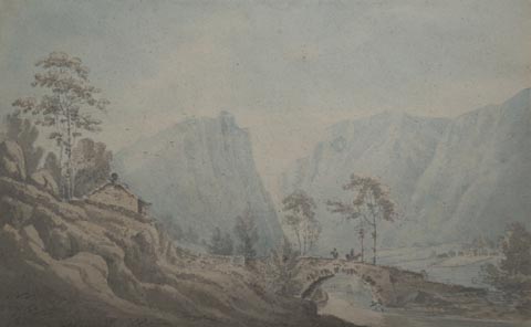 click to enlarge click to enlargePR1725.jpg courtesy of Abbot Hall Art Gallery, Kendal item:- Abbot Hall : SO32.94 Image © see bottom of page |
|
|
|
||
 Lakes Guides menu.