 Old Cumbria Gazetteer
 |
 |
|
| Rake Beck | ||
| runs into:- |  Duddon, River Duddon, River |
|
|
|
||
| locality:- | Wallowbarrow | |
| civil parish:- | Ulpha (formerly Cumberland) | |
| county:- | Cumbria | |
| locality type:- | river | |
| 1Km square:- | SD2296 (etc) | |
| 10Km square:- | SD29 | |
|
|
||
| evidence:- | old map:- OS County Series (Cmd 83 12) placename:- Rake Beck |
|
| source data:- | Maps, County Series maps of Great Britain, scales 6 and 25
inches to 1 mile, published by the Ordnance Survey, Southampton,
Hampshire, from about 1863 to 1948. |
|
|
|
||
| evidence:- | old map:- Donald 1774 (Cmd) |
|
| source data:- | Map, hand coloured engraving, 3x2 sheets, The County of Cumberland, scale about 1
inch to 1 mile, by Thomas Donald, engraved and published by Joseph Hodskinson, 29
Arundel Street, Strand, London, 1774.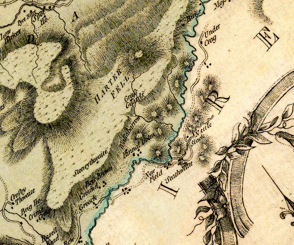 D4SD29NW.jpg single or double wiggly line; a river into the Duddon item:- Carlisle Library : Map 2 Image © Carlisle Library |
|
|
|
||
| evidence:- | old print:- Green 1815 |
|
| source data:- | Print, coloured aquatint, Wallowbarrow Crag, Ulpha, Cumberland, by William Green,
Ambleside, Westmorland, 1815.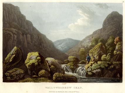 click to enlarge click to enlargeGN0556.jpg and the Rake Beck. Plate 60 in Lake Scenery. printed at upper right:- "60" printed at bottom:- "WALLOWBARROW CRAG. / Published at Ambleside, June 1, 1815, by Wm. Green." item:- Armitt Library : A6646.56 Image © see bottom of page |
|
|
|
||
Lakes Guides menu.