 Old Cumbria Gazetteer
 |
 |
|
| Moorhouse Hall, Moorhouse | ||
| Moorhouse Hall | ||
| locality:- | Moorhouse | |
| civil parish:- | Burgh by Sands (formerly Cumberland) | |
| county:- | Cumbria | |
| locality type:- | buildings | |
| coordinates:- | NY33165674 | |
| 1Km square:- | NY3356 | |
| 10Km square:- | NY35 | |
|
|
||
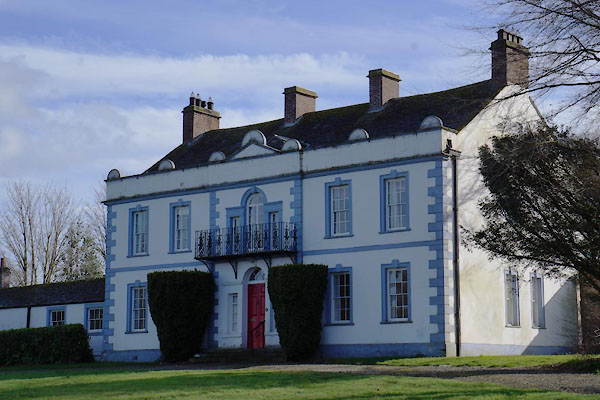 BZY43.jpg (taken 28.2.2014) 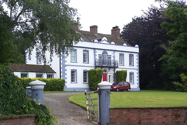 BNW25.jpg (taken 30.6.2007) |
||
|
|
||
| evidence:- | old map:- OS County Series (Cmd 23 1) placename:- Moorhouse Hall |
|
| source data:- | Maps, County Series maps of Great Britain, scales 6 and 25
inches to 1 mile, published by the Ordnance Survey, Southampton,
Hampshire, from about 1863 to 1948. |
|
|
|
||
| evidence:- | probably old map:- Donald 1774 (Cmd) placename:- Moorhouse |
|
| source data:- | Map, hand coloured engraving, 3x2 sheets, The County of Cumberland, scale about 1
inch to 1 mile, by Thomas Donald, engraved and published by Joseph Hodskinson, 29
Arundel Street, Strand, London, 1774.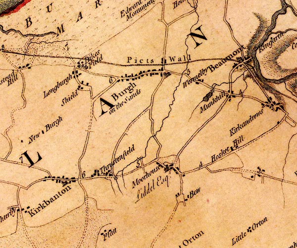 D4NY35NW.jpg "Moorhouse / Liddel Esqr." house item:- Carlisle Library : Map 2 Image © Carlisle Library |
|
|
|
||
| evidence:- | database:- Listed Buildings 2010 placename:- Moorhouse Hall |
|
| source data:- | courtesy of English Heritage "MOORHOUSE HALL / / / BURGH BY SANDS / CARLISLE / CUMBRIA / II / 78253 / NY3316056748" |
|
|
|
||
 Lakes Guides menu.