 Old Cumbria Gazetteer
 |
 |
|
| mine, Tyne Head | ||
| locality:- | Tyne Head (roughly) | |
| locality:- | Clargill Burn (2) | |
| civil parish:- | Alston Moor (formerly Cumberland) | |
| county:- | Cumbria | |
| locality type:- | mine (disused) | |
| coordinates:- | NY76903698 (etc) | |
| 1Km square:- | NY7636 | |
| 10Km square:- | NY73 | |
|
|
||
| evidence:- | old map:- Donald 1774 (Cmd) |
|
| source data:- | Map, hand coloured engraving, 3x2 sheets, The County of Cumberland, scale about 1
inch to 1 mile, by Thomas Donald, engraved and published by Joseph Hodskinson, 29
Arundel Street, Strand, London, 1774.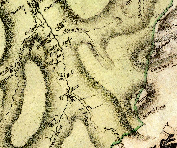 D4NY73NE.jpg cross (+) ?mine by Clargill Burn item:- Carlisle Library : Map 2 Image © Carlisle Library |
|
|
|
||
 Lakes Guides menu.