 Old Cumbria Gazetteer
 |
 |
|
| Low Holme Mire, Holme Low | ||
| Low Holme Mire | ||
| civil parish:- | Holme Low (formerly Cumberland) | |
| county:- | Cumbria | |
| locality type:- | marsh (now drained?) | |
| coordinates:- | NY128501 (etc etc) | |
| 1Km square:- | NY1250 | |
| 10Km square:- | NY15 | |
| references:- | Donald 1774 |
|
|
|
||
| evidence:- | old map:- Donald 1774 (Cmd) placename:- Low Holm Mire placename:- Holm Mire, Low |
|
| source data:- | Map, hand coloured engraving, 3x2 sheets, The County of Cumberland, scale about 1
inch to 1 mile, by Thomas Donald, engraved and published by Joseph Hodskinson, 29
Arundel Street, Strand, London, 1774.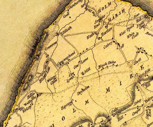 D4NY15SW.jpg 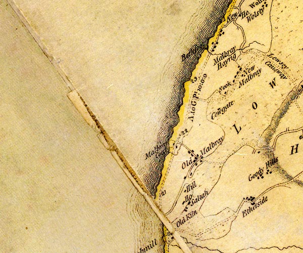 D4NY04NE.jpg 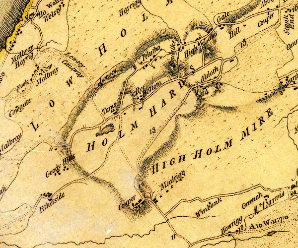 D4NY14NW.jpg "LOW HOLM MIRE" area of moss item:- Carlisle Library : Map 2 Images © Carlisle Library |
|
|
|
||
 Lakes Guides menu.