 Old Cumbria Gazetteer
 |
 |
|
| Hodgson How Quarry, Above Derwent | ||
| Hodgson How Quarry | ||
| locality:- | Hodgson How | |
| civil parish:- | Above Derwent (formerly Cumberland) | |
| county:- | Cumbria | |
| locality type:- | quarry | |
| locality type:- | slate quarry | |
| coordinates:- | NY24372362 | |
| 1Km square:- | NY2423 | |
| 10Km square:- | NY22 | |
|
|
||
| evidence:- | old map:- OS County Series (Cmd 64 5) |
|
| source data:- | Maps, County Series maps of Great Britain, scales 6 and 25
inches to 1 mile, published by the Ordnance Survey, Southampton,
Hampshire, from about 1863 to 1948. "Quarry" |
|
|
|
||
| evidence:- | old print:- Postlethwaite 1877 placename:- Hodgson How Quarry |
|
| source data:- | Print, halftone photograph, Hodgson How Quarry, looking SE, Above Derwent, Cumberland,
published by W H Moss and Sons, 13 Lowther Street, Whitehaven, Cumberland, 1877 edn
1913.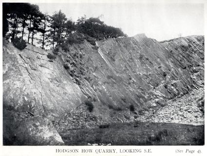 click to enlarge click to enlargePST302.jpg Tipped in opposite p.1 of Mines and Mining in the English Lake District, by John Postlethwaite. printed, bottom "HODGSON HOW QUARRY, LOOKING S.E. ..." item:- JandMN : 162.4 Image © see bottom of page |
|
|
|
||
| evidence:- | old print:- Postlethwaite 1877 placename:- Hodgson How Quarry |
|
| source data:- | Print, halftone photograph, Hodgson How Quarry, looking ENE, Above Derwent, Cumberland,
published by W H Moss and Sons, 13 Lowther Street, Whitehaven, Cumberland, 1877 edn
1913.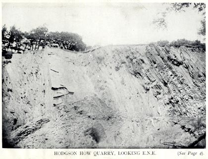 click to enlarge click to enlargePST303.jpg Tipped in opposite p.1 of Mines and Mining in the English Lake District, by John Postlethwaite. printed, bottom "HODGSON HOW QUARRY, LOOKING E.N.E. ..." item:- JandMN : 162.5 Image © see bottom of page |
|
|
|
||
| Glover, David: 2014: Quarries of Lakeland: Bookcase (Carlisle, Cumbria) |
||
|
|
||
 Lakes Guides menu.