 Old Cumbria Gazetteer
 |
 |
|
| Barrow Door, Above Derwent | ||
| Barrow Door | ||
| locality:- | Barrow | |
| locality:- | Stile End | |
| civil parish:- | Above Derwent (formerly Cumberland) | |
| county:- | Cumbria | |
| locality type:- | pass | |
| coordinates:- | NY22202173 | |
| 1Km square:- | NY2221 | |
| 10Km square:- | NY22 | |
|
|
||
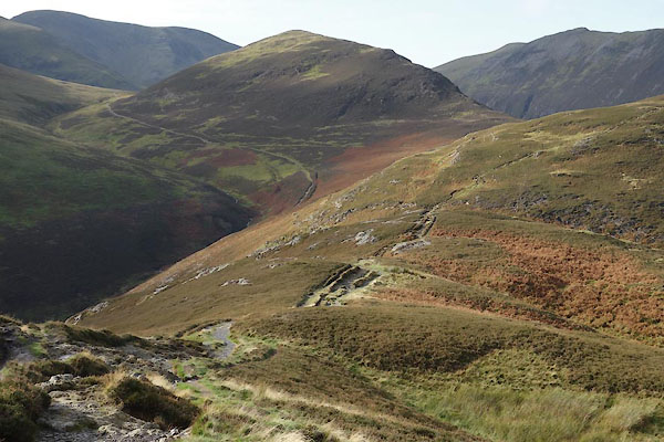 BZO03.jpg Looking from Barrow, Barrow Door is the dip immediately before you, the path continues up Stile End. (taken 24.10.2013) |
||
|
|
||
| evidence:- | old map:- OS County Series (Cmd 63 12) placename:- Barrow Door |
|
| source data:- | Maps, County Series maps of Great Britain, scales 6 and 25
inches to 1 mile, published by the Ordnance Survey, Southampton,
Hampshire, from about 1863 to 1948. |
|
|
|
||
 Lakes Guides menu.