 |
 |
|
|
|
|
Ashgill |
| civil parish:- |
Alston Moor (formerly Cumberland) |
| county:- |
Cumbria |
| locality type:- |
locality |
| locality type:- |
buildings |
| coordinates:- |
NY75904040 (etc) |
| 1Km square:- |
NY7540 |
| 10Km square:- |
NY74 |
|
|
| evidence:- |
old map:- Donald 1774 (Cmd)
placename:- Asgill
|
| source data:- |
Map, hand coloured engraving, 3x2 sheets, The County of Cumberland, scale about 1
inch to 1 mile, by Thomas Donald, engraved and published by Joseph Hodskinson, 29
Arundel Street, Strand, London, 1774.
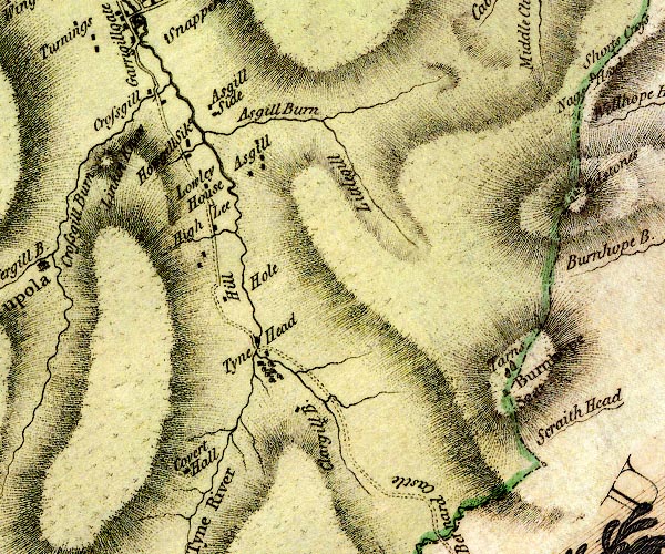
D4NY73NE.jpg
"Asgill"
block or blocks, labelled in lowercase; a hamlet or just a house
item:- Carlisle Library : Map 2
Image © Carlisle Library |
|
|
| places:- |
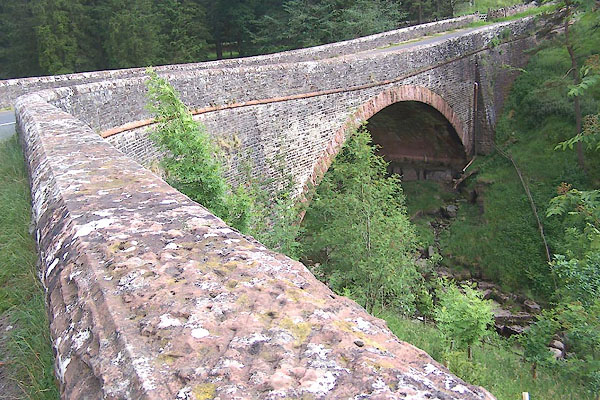 |
NY75904048 Ashgill Bridge (Alston Moor) |
|
|
 |
NY75864048 Ashgill Force (Alston Moor) |
|
|
|
NY76113982 High Ashgill (Alston Moor) |
|
|
|
NY76074079 limekiln, Alston Moor (39) (Alston Moor) |
|
|
|
NY75904034 Low Ashgill (Alston Moor) |
|
|
|
NY76044012 Mid Ashgill (Alston Moor) |
|
