 Old Cumbria Gazetteer
 |
 |
|
| Miterdale Head, Eskdale | ||
| Miterdale Head | ||
| locality:- | Miterdale | |
| civil parish:- | Eskdale (formerly Cumberland) | |
| county:- | Cumbria | |
| locality type:- | building/s (ruin) | |
| coordinates:- | NY16090246 | |
| 1Km square:- | NY1602 | |
| 10Km square:- | NY10 | |
|
|
||
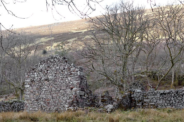 BYG49.jpg (taken 27.4.2013) |
||
|
|
||
| evidence:- | old map:- OS County Series (Cmd 79 10) placename:- Miterdale Head |
|
| source data:- | Maps, County Series maps of Great Britain, scales 6 and 25
inches to 1 mile, published by the Ordnance Survey, Southampton,
Hampshire, from about 1863 to 1948. |
|
|
|
||
| evidence:- | old map:- Mercator 1595 (edn?) placename:- Myterdale |
|
| source data:- | Map, hand coloured engraving, Northumbria, Cumberlandia, et
Dunelmensis Episcopatus, ie Northumberland, Cumberland and
Durham etc, scale about 6.5 miles to 1 inch, by Gerard Mercator,
Duisberg, Germany, about 1595. MER8CumE.jpg "Myterdale" circle item:- JandMN : 169 Image © see bottom of page |
|
|
|
||
| evidence:- | old map:- Donald 1774 (Cmd) placename:- Miterdale Head |
|
| source data:- | Map, hand coloured engraving, 3x2 sheets, The County of Cumberland, scale about 1
inch to 1 mile, by Thomas Donald, engraved and published by Joseph Hodskinson, 29
Arundel Street, Strand, London, 1774.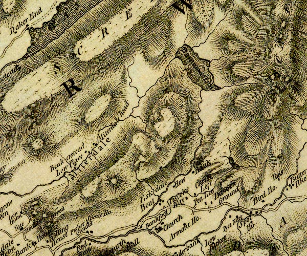 D4NY10SE.jpg "Miterdale Head" block or blocks, labelled in lowercase; a hamlet or just a house item:- Carlisle Library : Map 2 Image © Carlisle Library |
|
|
|
||
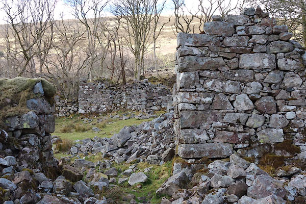 BYG50.jpg (taken 27.4.2013) 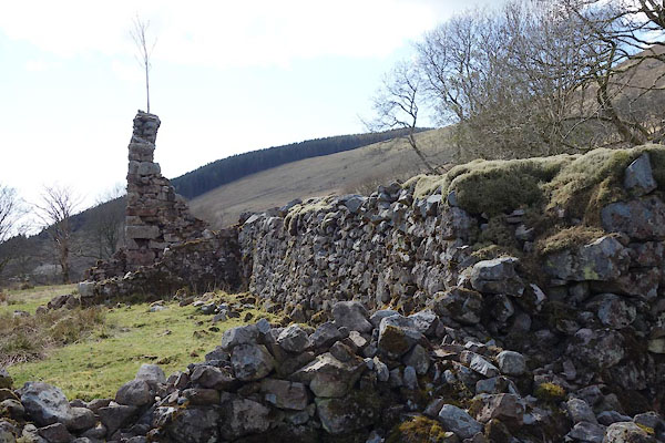 BYG51.jpg (taken 27.4.2013) |
||
|
|
||
 Lakes Guides menu.