 Old Cumbria Gazetteer
 |
 |
|
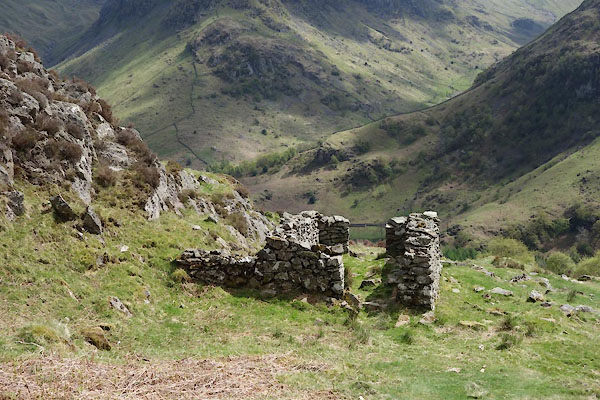
| building, Lingy End | ||
| locality:- | Lingy End | |
| civil parish:- | Borrowdale (formerly Cumberland) | |
| county:- | Cumbria | |
| locality type:- | buildings | |
| coordinates:- | NY26941384 | |
| 1Km square:- | NY2613 | |
| 10Km square:- | NY21 | |
|
|
||
 BYJ58.jpg (taken 22.5.2013) |
||
| This is the only visible bit of building within a short way of Huddleston's Shop,
qv. |
||
|
|
||
| evidence:- | old map:- OS County Series (Cmd 70 14) |
|
| source data:- | Maps, County Series maps of Great Britain, scales 6 and 25
inches to 1 mile, published by the Ordnance Survey, Southampton,
Hampshire, from about 1863 to 1948. Marked, but NOT labelled Huddleston's Shop or anything else. |
|
|
|
||
 Lakes Guides menu.