 Old Cumbria Gazetteer
 |
 |
|
|
| Westmorland: threapland 1 | |||
| Disputed Ground | |||
| locality:- | Mickle Fell | ||
| locality:- | Philip Reed Moss | ||
| locality:- | Lune Head | ||
| civil parish:- | Murton (formerly Westmorland) | ||
| civil parish:- | Warcop (formerly Westmorland) | ||
| county:- | Cumbria | ||
| locality type:- | threapland | ||
| locality type:- | county boundary | ||
| coordinates:- | NY814222 (etc) | ||
| 1Km square:- | NY8122 | ||
| 10Km square:- | NY82 | ||
| 10Km square:- | NY72 | ||
| county:- | Durham | ||
|
|
|||
| evidence:- | old map:- Jefferys 1770 |
||
| source data:- | Map, 4 sheets, The County of Westmoreland, scale 1 inch to 1
mile, surveyed 1768, and engraved and published by Thomas
Jefferys, London, 1770.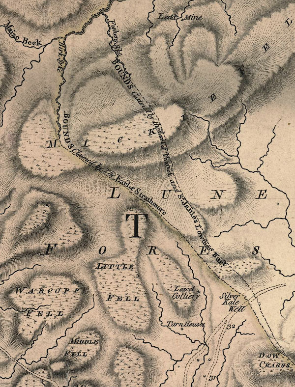 JEF5Th01.jpg two boundaries:- "BOUNDS Claimed by the Earl of Thanet and Sr. James Lowther Bart." "BOUNDS Claimed by the Earl of Strathmore" item:- National Library of Scotland : EME.s.47 Image © National Library of Scotland |
||
|
|
|||
| evidence:- | old map:- Jefferys 1770 (Wmd) |
||
| source data:- | Map, 4 sheets, The County of Westmoreland, scale 1 inch to 1
mile, surveyed 1768, and engraved and published by Thomas
Jefferys, London, 1770.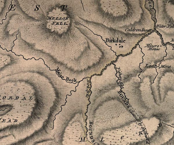 J5NY72NE.jpg 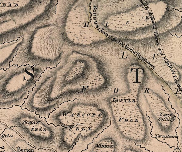 J5NY72SE.jpg 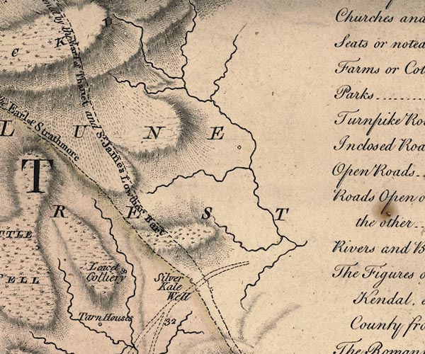 J5NY82SW.jpg "BOUNDS Claimed by The Earl of Strathmore / BOUNDS Claimed by the Earl of Thanet and Sr. James Lowther Bart" disputed ground item:- National Library of Scotland : EME.s.47 Images © National Library of Scotland |
||
|
|
|||
| evidence:- | old map:- Cary 1789 (edn 1805) |
||
| source data:- | Map, uncoloured engraving, Westmoreland, scale about 2.5 miles
to 1 inch, by John Cary, London, 1789; edition 1805. CY24Th01.jpg two boundaries, one is more definite item:- JandMN : 129 Image © see bottom of page |
||
|
|
|||
| evidence:- | old map:- Pigot 1826 |
||
| source data:- | Map, hand coloured engraving, Westmoreland ie Westmorland, scale
about 4.5 miles to 1 inch, by James Pigot and Co, Basing Lane,
London, 1826-27.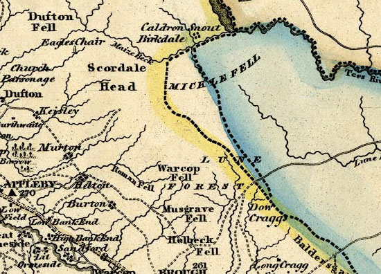 PIG8Th01.jpg two boundaries item:- Armitt Library : 2008.14.39 Image © see bottom of page |
||
|
|
|||
| evidence:- | old map:- Cruchley 1856 |
||
| source data:- | Railway map, colour printed, Railway and Station Map of
Cumberland, scale about 6.5 miles to 1 inch, by G F Cruchley, 81
Fleet Street, London, 1850s-60s?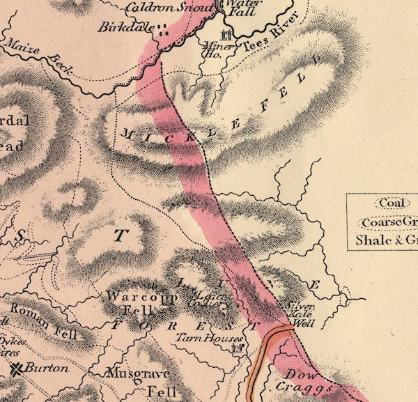 CRU2Th01.jpg two boundaries, one is definite, the other not to be confused with coal and grit areas item:- JandMN : 152 Image © see bottom of page |
||
|
|
|||
| evidence:- | old map:- Bartholomew 1940s |
||
| source data:- | Map, colour lithograph, Bartholomew's Revised Half Inch
Contoured Maps, sheet 35, Teesdale, scale about 2 miles to 1
inch, by John Bartholomew and Sons, The Edinburgh Geographical
Institute, Duncan Street, Edinburgh, Lothian, Scotland, 1952.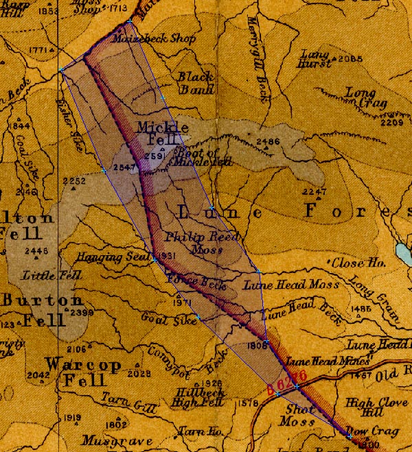 BA22Th01.jpg item:- JandMN : 828.35 Image © see bottom of page |
||
|
|
|||
| mapping:- |  boundary stone, Stainmore (5) Hanging Stone, Stainmore boundary stone, Stainmore (7) Hanging Seal, Warcop boundary stone, Stainmore (5) Hanging Stone, Stainmore boundary stone, Stainmore (7) Hanging Seal, Warcop |
||
|
|
|||
| mapping:- | boundary stone, Warcop Hanging Seal, Warcop boundary stone, Stainmore (5) Hanging Stone, Stainmore |
||
|
|
|||
Lakes Guides menu.