 Old Cumbria Gazetteer
 |
 |
|
| West Yorkshire | ||
| Yorkshire | ||
| locality type:- | county | |
|
|
||
| evidence:- | old map:- Badeslade 1742 placename:- York Shire |
|
| source data:- | Map, hand coloured engraving, A Map of Yorkshire North from
London, scale about 24 miles to 1 inch, with descriptive text,
by Thomas Badeslade, London, engraved and published by William
Henry Toms, Union Court, Holborn, London, 1742.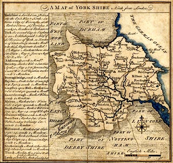 click to enlarge click to enlargeBD16.jpg "York Shire" county item:- private collection : 162 Image © see bottom of page |
|
|
|
||
| evidence:- | old map:- Cooke 1802 placename:- West Riding of Yorkshire |
|
| source data:- | Map, West Riding of Yorkshire, ie West Yorkshire, scale about 21
miles to 1 inch, by George Cooke, 1802, bound in Gray's New Book
of Roads, 1824, published by Sherwood, Jones and Co, Paternoster
Road, London, 1824.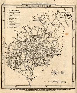 click to enlarge click to enlargeGRA1Wy.jpg "WEST RIDING OF YORKSHIRE" map title item:- Hampshire Museums : FA2000.62.12 Image © see bottom of page |
|
|
|
||
| see:- |  Cumbria Cumbria |
|
|
|
||
Lakes Guides menu.