 Old Cumbria Gazetteer
 |
 |
|
| waterfall, Uldale | ||
| site name:- | Rawthey, River | |
| locality:- | Uldale | |
| civil parish:- | Ravenstonedale (formerly Westmorland) | |
| county:- | Cumbria | |
| locality type:- | waterfall | |
| coordinates:- | SD734958 (etc) | |
| 1Km square:- | SD7395 | |
| 10Km square:- | SD79 | |
|
|
||
| evidence:- | old map:- Jefferys 1770 (Wmd) |
|
| source data:- | Map, 4 sheets, The County of Westmoreland, scale 1 inch to 1
mile, surveyed 1768, and engraved and published by Thomas
Jefferys, London, 1770.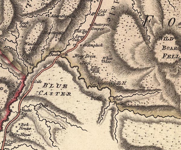 J5SD79NW.jpg "Water Falls" waterfall item:- National Library of Scotland : EME.s.47 Image © National Library of Scotland |
|
|
|
||
 Lakes Guides menu.