 Old Cumbria Gazetteer
 |
 |
|
| Stocks Mill, Skelsmergh | ||
| Stocks Mill | ||
| locality:- | St John's Well | |
| locality:- | Stocks | |
| civil parish:- | Skelsmergh (formerly Westmorland) | |
| county:- | Cumbria | |
| locality type:- | water mill | |
| locality type:- | mill | |
| locality type:- | bobbin mill | |
| locality type:- | bark mill | |
| locality type:- | corn mill | |
| locality type:- | tanyard | |
| coordinates:- | SD52909677 | |
| 1Km square:- | SD5296 | |
| 10Km square:- | SD59 | |
|
|
||
| evidence:- | old map:- OS County Series (Wmd 33 12) placename:- Stocks Mill |
|
| source data:- | Maps, County Series maps of Great Britain, scales 6 and 25
inches to 1 mile, published by the Ordnance Survey, Southampton,
Hampshire, from about 1863 to 1948. "Stocks Mill (Bobbin)" |
|
| source data:- | Maps, County Series maps of Great Britain, scales 6 and 25
inches to 1 mile, published by the Ordnance Survey, Southampton,
Hampshire, from about 1863 to 1948. "Mill Race" showing a mill dam above the mill race, fed from a spring near Otter Bank |
|
|
|
||
| evidence:- | old map:- Jefferys 1770 (Wmd) |
|
| source data:- | Map, 4 sheets, The County of Westmoreland, scale 1 inch to 1
mile, surveyed 1768, and engraved and published by Thomas
Jefferys, London, 1770.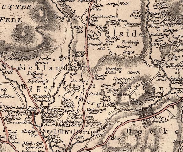 J5SD59NW.jpg "Paper Mill" circle with rays; water mill item:- National Library of Scotland : EME.s.47 Image © National Library of Scotland |
|
|
|
||
| evidence:- | old map:- Cary 1789 (edn 1805) |
|
| source data:- | Map, uncoloured engraving, Westmoreland, scale about 2.5 miles
to 1 inch, by John Cary, London, 1789; edition 1805.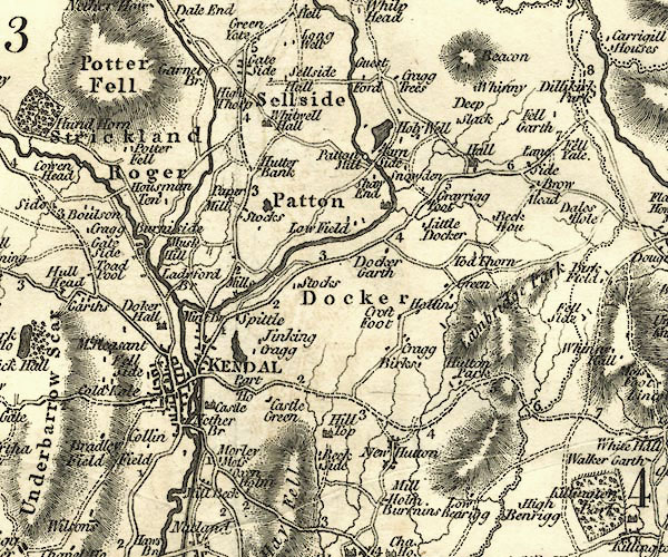 CY24SD59.jpg "Paper Mill" circle with rays; water mill item:- JandMN : 129 Image © see bottom of page |
|
|
|
||
| references:- |
The mill's history and its various uses from the late 16th century to the present
day are described in:- |
|
| Cousins, Tony: 2017 (November): Stocks Mill & Skelsmergh Local History Notes No.31:
Skelsmergh, Selside and Longsleddale Church and Community News |
||
|
|
||
 Lakes Guides menu.