 Old Cumbria Gazetteer
 |
 |
|
|
| road, through Rookby | |||
| suggested | |||
| Kirkby Stephen to Tan Hill | |||
| Tan Hill to Kirkby Stephen | |||
| civil parish:- | Kirkby Stephen (formerly Westmorland) | ||
| civil parish:- | Hartley (formerly Westmorland) | ||
| civil parish:- | Winton (formerly Westmorland) | ||
| civil parish:- | Kaber (formerly Westmorland) | ||
| county:- | Cumbria | ||
| locality type:- | road route | ||
| 10Km square:- | NY70 | ||
| 10Km square:- | NY71 | ||
| 10Km square:- | NY81 | ||
| county:- | North Yorkshire | ||
| references:- | Jefferys 1770 |
||
|
|
|||
| evidence:- | old map:- Jefferys 1770 (Wmd) |
||
| source data:- | Map, 4 sheets, The County of Westmoreland, scale 1 inch to 1
mile, surveyed 1768, and engraved and published by Thomas
Jefferys, London, 1770.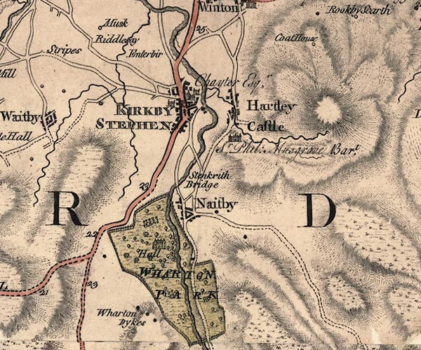 J5NY70NE.jpg 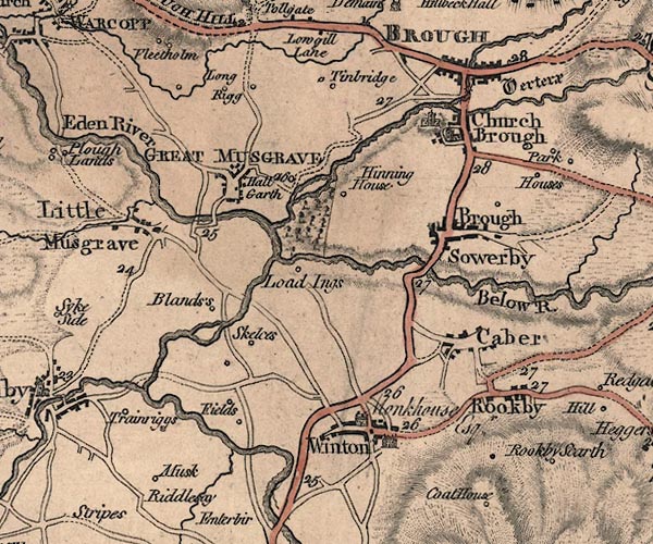 J5NY71SE.jpg 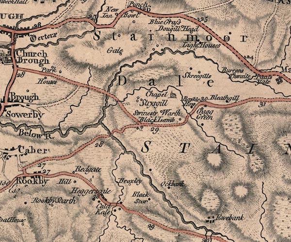 J5NY81SW.jpg 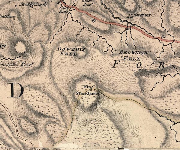 J5NY80NW.jpg 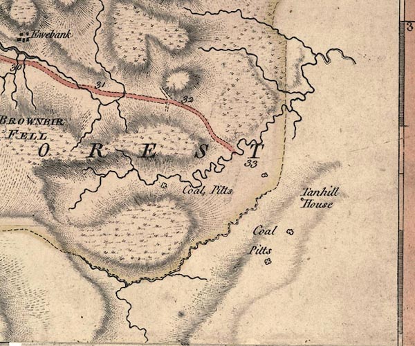 J5NY80NE.jpg double line; road, with mile numbers item:- National Library of Scotland : EME.s.47 Images © National Library of Scotland |
||
|
|
|||
| place:- |  Kirkby Stephen Winton Rookby, Kaber Tan Hill, North Yorkshire Kirkby Stephen Winton Rookby, Kaber Tan Hill, North Yorkshire |
||
|
|
|||
Lakes Guides menu.