 Old Cumbria Gazetteer
 |
 |
|
|
| road, through Meathop and Ulpha | |||
| suggested | |||
| Meathop and Ulpha road | |||
| civil parish:- | Helsington (formerly Westmorland) | ||
| civil parish:- | Witherslack (formerly Westmorland) | ||
| civil parish:- | Meathop and Ulpha (formerly Westmorland) | ||
| county:- | Cumbria | ||
| locality type:- | road route | ||
| 10Km square:- | SD48 | ||
| references:- | Jefferys 1770 |
||
|
|
|||
| evidence:- | old map:- Jefferys 1770 (Wmd) |
||
| source data:- | Map, 4 sheets, The County of Westmoreland, scale 1 inch to 1
mile, surveyed 1768, and engraved and published by Thomas
Jefferys, London, 1770.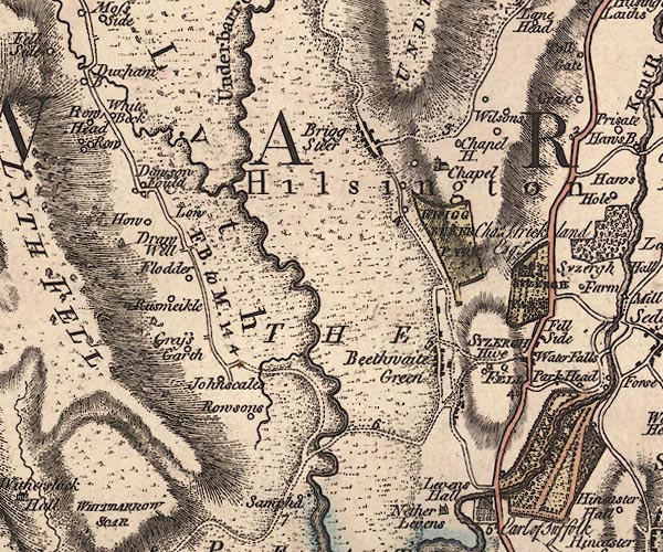 J5SD48NE.jpg 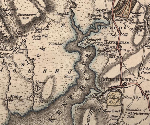 J5SD48SE.jpg 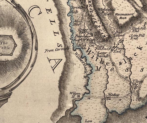 J5SD48SW.jpg double line; road, with mile numbers item:- National Library of Scotland : EME.s.47 Images © National Library of Scotland |
||
|
|
|||
| place:- | Not all this route exists now as a navigable track or road.  Sizergh, Helsington Levens Sampool Bridge, Levens Town End, Witherslack Ulpha, Meathop and Ulpha Meathop Meathop Bridge, Meathop and Ulpha Sizergh, Helsington Levens Sampool Bridge, Levens Town End, Witherslack Ulpha, Meathop and Ulpha Meathop Meathop Bridge, Meathop and Ulpha |
||
|
|
|||
Lakes Guides menu.