 Old Cumbria Gazetteer
 |
 |
|
|
| included in:- |
 road, Ulverston to Coniston road, Ulverston to Coniston |
||
| road, Greenodd to Torver | |||
| Greenodd to Torver | |||
| Torver to Greenodd | |||
| A5084 | |||
| civil parish:- | Egton with Newland (formerly Lancashire) | ||
| civil parish:- | |||
| civil parish:- | Torver (formerly Lancashire) | ||
| county:- | Cumbria | ||
| locality type:- | route | ||
| 10Km square:- | SD38 | ||
| 10Km square:- | SD28 | ||
| 10Km square:- | SD29 | ||
|
|
|||
| evidence:- | old map:- Crosthwaite 1783-94 (Con) |
||
| source data:- | Map, uncoloured engraving, An Accurate Map of Coniston Lake,
scale about 3 inches to 1 mile, by Peter Crosthwaite, Keswick,
Cumberland, 1788, version published 1809.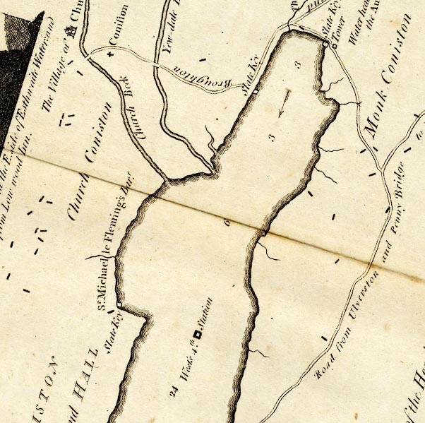 CTESD39D.jpg 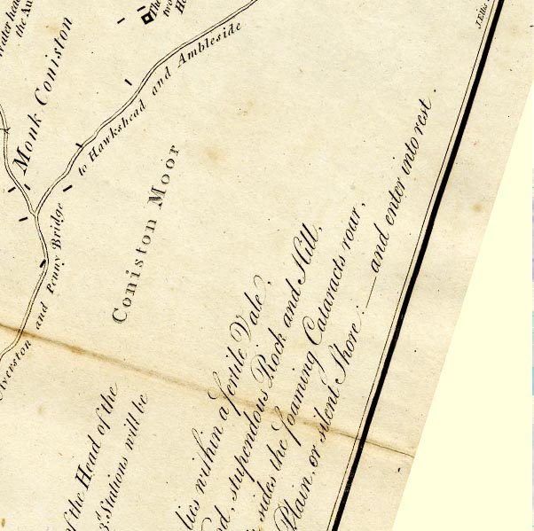 CTESD39I.jpg 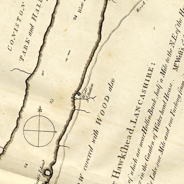 CTESD39C.jpg 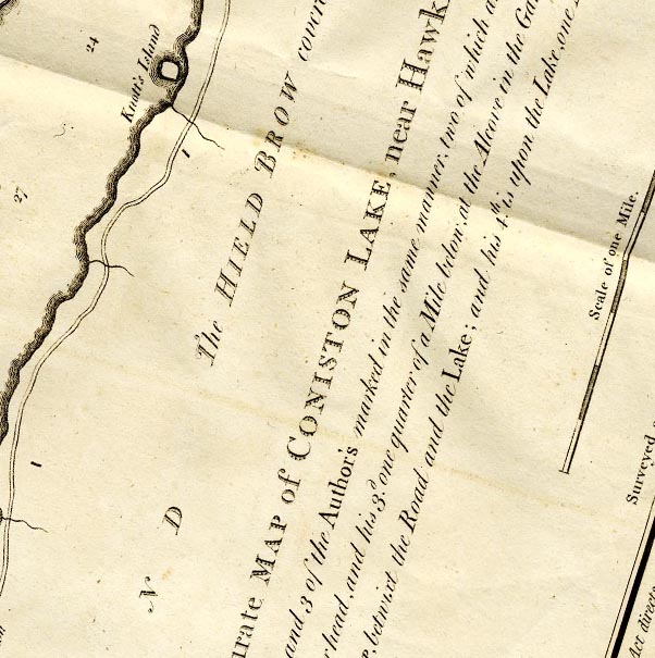 CTESD39B.jpg 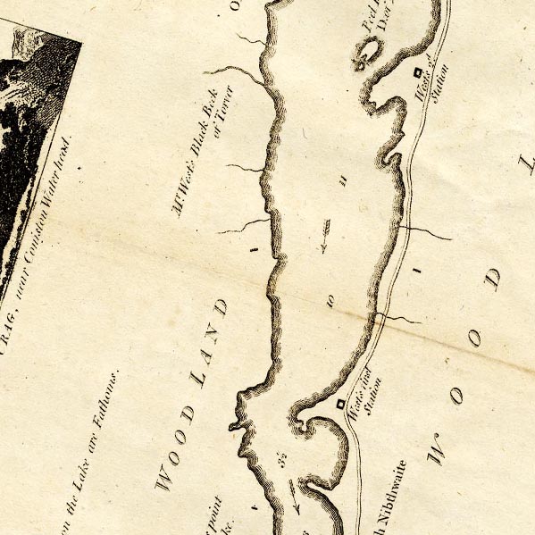 CTESD29V.jpg 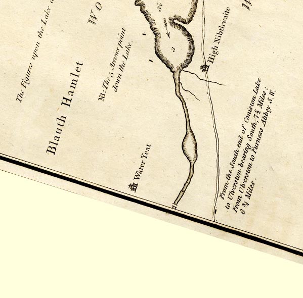 CTESD28Z.jpg double line:- "Road from Ulverston and Penny Bridge to Hawkshead and Ambleside" "From the South end of Coniston Lake to Ulverston bearing South; 7½Miles: ..." item:- JandMN : 182.5 Image © see bottom of page |
||
|
|
|||
| evidence:- | old strip map:- Rumney 1899 |
||
| source data:- | Road map, strip map, gradient diagram, and itinerary for Route IV, Greenodd to Coniston,
Lancashire, scale about 2 miles to 1 inch, by A W Rumney, published by George Philip
and Son, 32 Fleet Street, London, and Liverpool, 1899.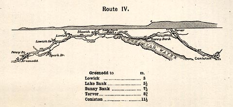 click to enlarge click to enlargeRUM106.jpg On p.26 of the Cyclist's Guide to the English Lake District, by A W Rumney. printed at top:- "Route IV." item:- JandMN : 147.7 Image © see bottom of page |
||
|
|
|||
| places:- | Greenodd Penny Bridge, Egton with Newland Lowick Blawith Torver |
||
|
|
|||
Lakes Guides menu.