 Old Cumbria Gazetteer
 |
 |
|
| Querlokens, Solport | ||
| supposed | ||
| Querlokens | ||
| civil parish:- | Solport (formerly Cumberland) | |
| county:- | Cumbria | |
| locality type:- | buildings | |
| coordinates:- | NY495750 (guess) | |
| 1Km square:- | NY4975 | |
| 10Km square:- | NY47 | |
|
|
||
| evidence:- | possibly old map:- Burghley 1590 (facsimile) |
|
| source data:- | Facsimile map, A Platt of the Opposete Border of Scotland to ye West Marches of England,
parts of Cumberland and Scotland including the Debateable Land, from a manuscript
drawn for William Cecil, Lord Burghley, about 1590, published by R B Armstrong, 1897. courtesy of the National Library of Scotland 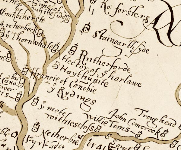 M048NY47.jpg "John Comcrook" circle, tower; across the river from Cumcrook item:- National Library of Scotland : MS6113 f.267 Image © National Library of Scotland |
|
|
|
||
| evidence:- | old map:- placename:- Querlokens |
|
| source data:- | : 1607: Platt of the Forest of Nicholl and the Manor of Liddale ...: Trans CWAAS:
2nd series vol.14: opp p.148 "Querlokens" |
|
|
|
||
 Lakes Guides menu.