 Old Cumbria Gazetteer
 |
 |
|
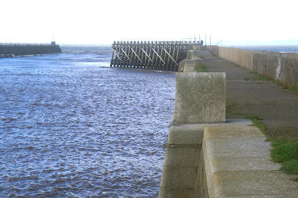
| North Pier, Maryport Harbour | ||
| North Pier | ||
| locality:- | Maryport Harbour | |
| locality:- | Maryport | |
| civil parish:- | Maryport (formerly Cumberland) | |
| county:- | Cumbria | |
| locality type:- | quay | |
| coordinates:- | NY03183680 (etc) | |
| 1Km square:- | NY0336 | |
| 10Km square:- | NY03 | |
|
|
||
 CFN67.jpg (taken 30.9.2016) 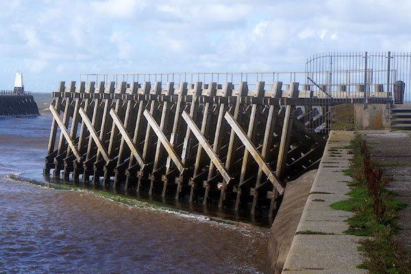 CFN68.jpg (taken 30.9.2016) |
||
|
|
||
| evidence:- | old map:- OS County Series (Cmd 44 8) placename:- North Pier |
|
| source data:- | Maps, County Series maps of Great Britain, scales 6 and 25
inches to 1 mile, published by the Ordnance Survey, Southampton,
Hampshire, from about 1863 to 1948. |
|
|
|
||
| evidence:- | old text:- Admiralty 1933 placename:- North Pier item:- navigation lights |
|
| source data:- |  goto source goto sourcePage 396:- "..." "... Maryport harbour ... is contained within North pier, which projects westward, for a distance of about 1,200 feet (365m8), from the north-eastern point of the entrance to the River Ellen, to a position about 160 feet (48m8) northward of the southern point of the entrance. ..." goto sourcePage 397:- "..." "A light is exhibited, at an elevation of 32 feet (9m8), from a white column, 20 feet (6m1) in height, situated at the head of North pier." "..." "From the end of the North pier, a large linked chain extends seaward, parallel with the wooden pier, for the purpose of catching the anchors of sailing vessels which have missed the harbour, to prevent them drifting on to the North beach." |
|
|
|
||
Lakes Guides menu.