 Old Cumbria Gazetteer
 |
 |
|
| Middleton Mill, Middleton | ||
| Middleton Mill | ||
| site name:- | Larum Gill | |
| civil parish:- | Middleton (formerly Westmorland) | |
| county:- | Cumbria | |
| locality type:- | buildings | |
| locality type:- | water mill (ex) | |
| locality type:- | mill (ex) | |
| locality type:- | corn mill (ex) | |
| coordinates:- | SD62628702 | |
| 1Km square:- | SD6287 | |
| 10Km square:- | SD68 | |
|
|
||
| evidence:- | old map:- OS County Series (Wmd 44 1) placename:- Middleton Mill |
|
| source data:- | Maps, County Series maps of Great Britain, scales 6 and 25
inches to 1 mile, published by the Ordnance Survey, Southampton,
Hampshire, from about 1863 to 1948. "Middleton Mill (Corn) / Mill Race" |
|
|
|
||
| evidence:- | old map:- Jefferys 1770 (Wmd) |
|
| source data:- | Map, 4 sheets, The County of Westmoreland, scale 1 inch to 1
mile, surveyed 1768, and engraved and published by Thomas
Jefferys, London, 1770.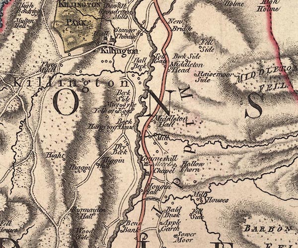 J5SD68NW.jpg "Mill" circle with rays; water mill item:- National Library of Scotland : EME.s.47 Image © National Library of Scotland |
|
|
|
||
 Lakes Guides menu.