 Old Cumbria Gazetteer
 |
 |
|
| Isle of Man | ||
| country:- | Isle of Man | |
| locality type:- | country | |
| locality type:- | island | |
| 10Km square:- | SC48 (etc) | |
| 10Km square:- | SC48 | |
|
|
||
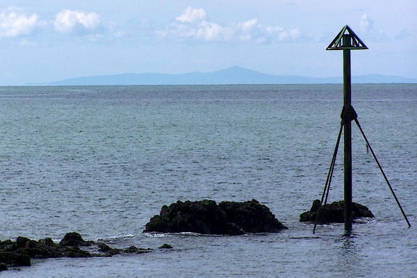 BNQ41.jpg Calm sea, from Harrington Harbour; the Isle of Man. (taken 14.5.2007) 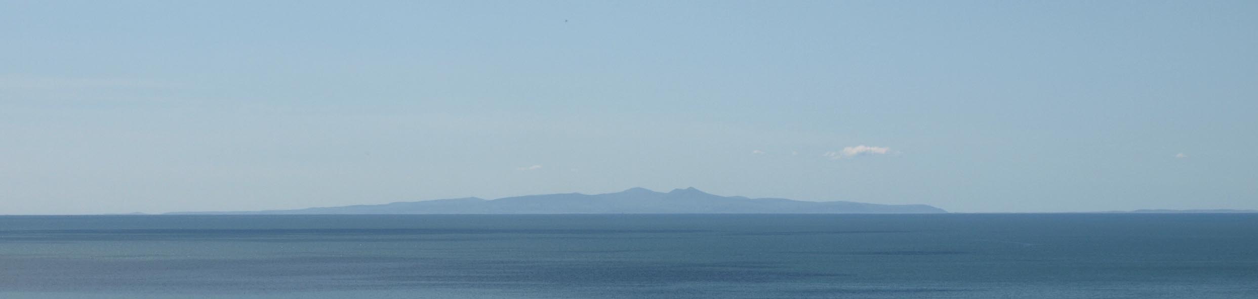 Click to enlarge BQN76.jpg The Isle of Man, from near St Bees. (taken 11.5.2009) |
||
|
|
||
| evidence:- | old map:- Ptolemy 1540 placename:- Mana |
|
| source data:- | Map, copy, uncoloured lithograph? Anglia II Nova Tabula, New Map
of England, scale about 50 miles to 1 inch, data in the
Geographia by Claudius Ptolemy, engraved by Sebastian Munster,
Basle, Switzerland, 1540.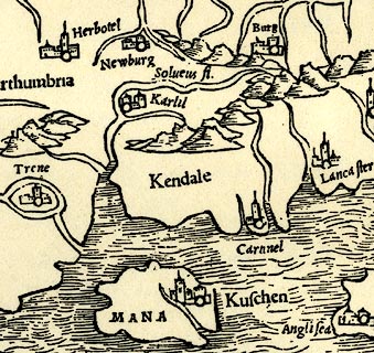 click to enlarge click to enlargePTY4Cm.jpg "MANA" island item:- private collection : 131 Image © see bottom of page |
|
|
|
||
| evidence:- | old chart:- Gibson 1760 placename:- Irish Sea |
|
| source data:- | Chart, uncoloured engraving, A Correct Chart of the Irish Sea, scale about 43 miles
to 1 inch, engraved by J Gibson, published by the Gentleman's Magazine, 1760. click to enlarge click to enlargeGM20Cm.jpg Folded and tipped in opposite p.108 in the Gentleman's Magazine vol.30, 1760. There is descriptive text pp.107-112. printed at plain cartouche, lower left:- "A Correct Chart of the / IRISH SEA, &C. / exhibiting a View / of the / several Islands &Bays / lately touch'd at by / M. THUROT, / in his Attempt upon / IRELAND" printed at lower right:- "J. Gibson sculpt." printed at with scale line:- "A Scale of Miles 60 to a Degree" item:- Armitt Library : A5735 (5) Image © see bottom of page |
|
|
|
||
| evidence:- | road book:- Cary 1798 (2nd edn 1802) item:- boat; steamship; packet boat; letters; post |
|
| source data:- | Road book, itineraries, Cary's New Itinerary, by John Cary, 181
Strand, London, 2nd edn 1802. goto source goto source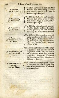 click to enlarge click to enlargeC38798.jpg page 798 "At WHITEHAVEN, for the ISLE OF MAN. / The Packet Boat carrying the Letters to and from the Isle of Man sails from Whitehaven once a Week, and returns as often." item:- JandMN : 228.2 Image © see bottom of page |
|
|
|
||
| evidence:- | old text:- Church Commission 1836 |
|
| source data:- | Diocesan map, proposed new Carlisle and Man Diocese, by the
Church Commissioners, scale about 10.5 miles to 1 inch,
lithographed by Samuel Arrowsmith, published by the House of
Commons, Westminster, London, 1836. Recommendation:- "24. That the Sees of Carlisle and Sodor and Man be united, and that the Diocese consist of the present Diocese of Carlisle, and those Parts of Cumberland and Westmoreland which are now in the Diocese of Chester, of the Deanery of Furnes and Cartmel in the County of Lancaster, of the Parish of Aldeston, now in the Diocese of Durham, and the Isle of Man." Archdeaconries and Deaneries are listed:- "..." "Archdeaconry of Isle of Man - was Diocese of Sodor and Man" |
|
|
|
||
| evidence:- | old drawing:- Aspland 1840s-60s placename:- Isle of Man |
|
| source data:- | Drawing, pencil, Isle of Man, seen from Hard Knott, Cumberland, by Theophilus Lindsey
Aspland, 1852.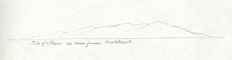 click to enlarge click to enlargeAS0340.jpg "Isle of Man as seen from Hardknot." page number "30" item:- Armitt Library : 1958.390.40 Image © see bottom of page |
|
|
|
||
| evidence:- | old painting:- item:- ship |
|
| source data:- | Painting, watercolour, Isle of Man from Seascale, Cumberland, by Frederick Clive Newcome,
1893.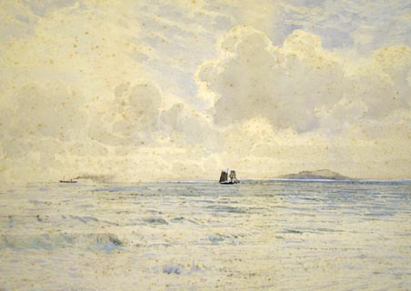 click to enlarge click to enlargePR1155.jpg Distant view of the Isle of Man across a calm sea with a steamer crossing the horizon to left of composition and a sailboat in the centre. signed &dated at bottom left:- "NEWCOME '93" item:- Tullie House Museum : 1974.60.3 Image © Tullie House Museum |
|
|
|
||
| evidence:- | outline view:- Tattersall 1836 item:- panorama |
|
| source data:- | Print, engraving, View from Skiddaw, looking West, Cumberland, drawn by George Tattersall,
engraved by W F Topham, published by Sherwood and Co, Paternoster Row, London, about
1836.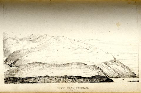 click to enlarge click to enlargeTAT138.jpg Tipped in opposite p.92 of The Lakes of England, by George Tattersall. printed at bottom:- "VIEW FROM SKIDDAW, / looking West. / [London Pubd. ...]" printed at p.92:- "... FOUR VIEWS FROM THE SUMMIT OF SKIDDAW. IV. LOOKING WEST. / ... / 20. Isle of Man. / ..." item:- Armitt Library : A1204.39 Image © see bottom of page |
|
|
|
||
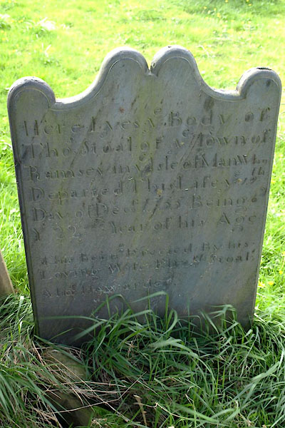 BUI06.jpg gravestone:- "Here Lyes ye Body of / Thos. Stoal of ye Town of / Ramsey in ye Isle of Man who / Departed this Life ye [19]th / Day of Decr. 1755 Being [ ] / Y[e] 22nd Year of his Age / ..." (taken 3.4.2011) |
||
| Thomas Stoal of the Isle of Man was drowned whilst on a smuggling trip. The gravestone
of slate from Snaefell was carried, as a penance, by Thomas's wife from Maryport to
Bowness. |
||
|
|
||
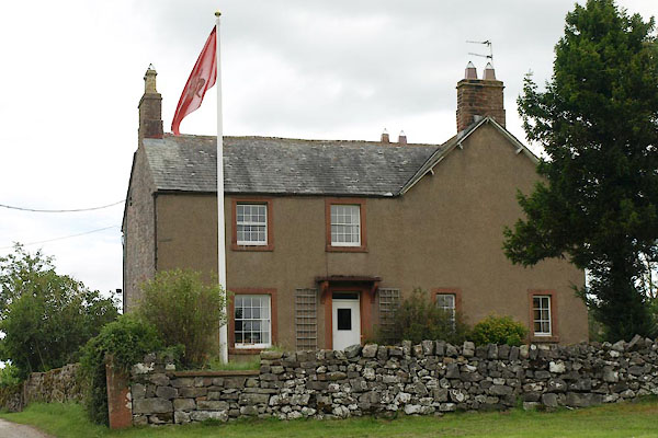 BVF78.jpg A house in Newbiggin, Dacre, flying the flag of the Isle of Man. (taken 19.8.2011) |
||
|
|
||
Lakes Guides menu.