 Old Cumbria Gazetteer
 |
 |
|
| High Burtergill, Warcop | ||
| gone | ||
| High Burtergill | ||
| civil parish:- | Warcop (formerly Westmorland) | |
| county:- | Cumbria | |
| locality type:- | buildings | |
| coordinates:- | NY76831576 | |
| 1Km square:- | NY7615 | |
| 10Km square:- | NY71 | |
|
|
||
| evidence:- | old map:- OS County Series (Wmd 16 10) placename:- High Burtergill placename:- Burtergill, High |
|
| source data:- | Maps, County Series maps of Great Britain, scales 6 and 25
inches to 1 mile, published by the Ordnance Survey, Southampton,
Hampshire, from about 1863 to 1948. Two places marked with this name, the other at NY76851617 where there is now a 'bunker' |
|
|
|
||
| evidence:- | old map:- Jefferys 1770 (Wmd) placename:- Burtergill |
|
| source data:- | Map, 4 sheets, The County of Westmoreland, scale 1 inch to 1
mile, surveyed 1768, and engraved and published by Thomas
Jefferys, London, 1770.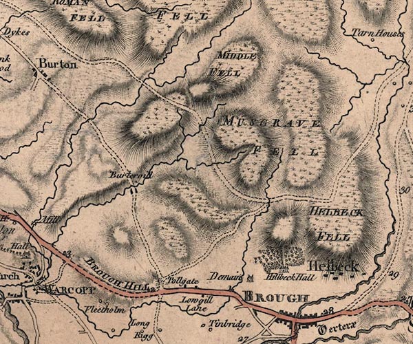 J5NY71NE.jpg "Burtergill" blocks, labelled in italic lowercase text; settlement, village? item:- National Library of Scotland : EME.s.47 Image © National Library of Scotland |
|
|
|
||
 Lakes Guides menu.