 Old Cumbria Gazetteer
 |
 |
|
| Brocklebank Fell, Westward | ||
| suggested | ||
| Brocklebank Fell | ||
| locality:- | Brocklebank | |
| civil parish:- | Westward (formerly Cumberland) | |
| county:- | Cumbria | |
| locality type:- | hill | |
| coordinates:- | NY304423 | |
| 1Km square:- | NY3042 | |
| 10Km square:- | NY34 | |
|
|
||
| evidence:- | old map:- Donald 1774 (Cmd) placename:- Brocklebank Fell |
|
| source data:- | Map, hand coloured engraving, 3x2 sheets, The County of Cumberland, scale about 1
inch to 1 mile, by Thomas Donald, engraved and published by Joseph Hodskinson, 29
Arundel Street, Strand, London, 1774.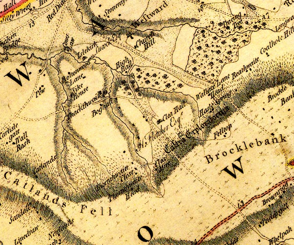 D4NY24SE.jpg 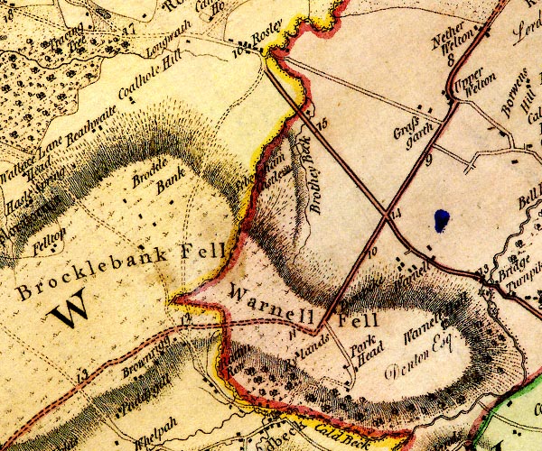 D4NY34SW.jpg "Brocklebank Fell" hill hachuring; a hill or mountain item:- Carlisle Library : Map 2 Images © Carlisle Library |
|
|
|
||
| evidence:- | old map:- Cooper 1808 placename:- Broclebank Fell |
|
| source data:- | Map, uncoloured engraving, Cumberland, scale about 10.5 miles to
1 inch, drawn and engraved by Cooper, published by R Phillips,
Bridge Street, Blackfriars, London, 1808. click to enlarge click to enlargeCOP3.jpg "Broclebank Fell" hill hachuring; mountain or hill item:- JandMN : 86 Image © see bottom of page |
|
|
|
||
 Lakes Guides menu.