 Old Cumbria Gazetteer
 |
 |
|
| Barren Fell, Boltons | ||
| Barren Fell | ||
| civil parish:- | Boltons (formerly Cumberland) | |
| county:- | Cumbria | |
| locality type:- | hill | |
| coordinates:- | NY26673985 (etc etc) | |
| 1Km square:- | NY2639 | |
| 10Km square:- | NY23 | |
| SummaryText:- | cf trig point data | |
|
|
||
| evidence:- | possibly old map:- Cooper 1808 placename:- Catlands Fell |
|
| source data:- | Map, uncoloured engraving, Cumberland, scale about 10.5 miles to
1 inch, drawn and engraved by Cooper, published by R Phillips,
Bridge Street, Blackfriars, London, 1808. click to enlarge click to enlargeCOP3.jpg "Catlands Fell" hill hachuring; mountain or hill item:- JandMN : 86 Image © see bottom of page |
|
|
|
||
| evidence:- | old map:- Garnett 1850s-60s H placename:- Brocklebank Fell |
|
| source data:- | Map of the English Lakes, in Cumberland, Westmorland and
Lancashire, scale about 3.5 miles to 1 inch, published by John
Garnett, Windermere, Westmorland, 1850s-60s.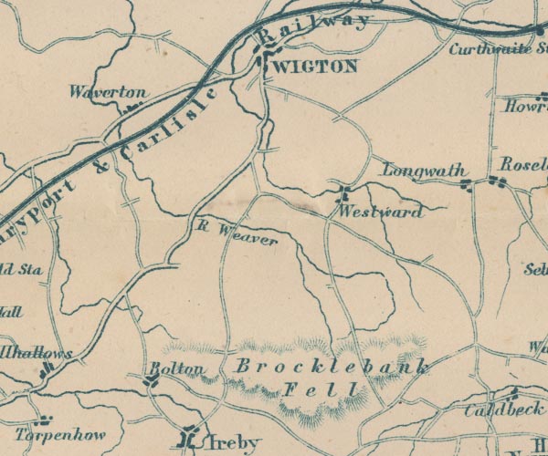 GAR2NY24.jpg "Brocklebank Fell" hill hachuring item:- JandMN : 82.1 Image © see bottom of page |
|
|
|
||
 Lakes Guides menu.