 Old Cumbria Gazetteer
 |
 |
|
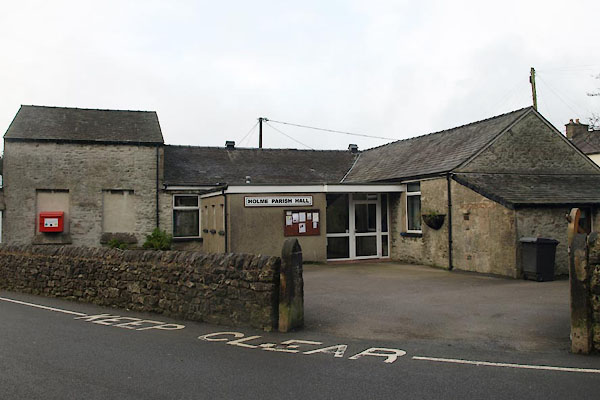
| Holme Parish Hall, Holme | ||
| Holme Parish Hall | ||
| locality:- | Holme | |
| civil parish:- | Holme (formerly Westmorland) | |
| county:- | Cumbria | |
| locality type:- | village hall | |
| locality type:- | school (ex) | |
| coordinates:- | SD52307885 | |
| 1Km square:- | SD5278 | |
| 10Km square:- | SD57 | |
|
|
||
 BVU18.jpg (taken 6.1.2012) |
||
|
|
||
| evidence:- | old map:- OS County Series (Wmd 46 8) |
|
| source data:- | Maps, County Series maps of Great Britain, scales 6 and 25
inches to 1 mile, published by the Ordnance Survey, Southampton,
Hampshire, from about 1863 to 1948. "National School" |
|
|
|
||
 Lakes Guides menu.