 Old Cumbria Gazetteer
 |
 |
|
| Bowder Crag, Borrowdale | ||
| Bowder Crag | ||
| Bowderstone Crags | ||
| civil parish:- | Borrowdale (formerly Cumberland) | |
| county:- | Cumbria | |
| locality type:- | rocks | |
| coordinates:- | NY25531648 (etc) | |
| 1Km square:- | NY2516 | |
| 10Km square:- | NY21 | |
|
|
||
| evidence:- | old map:- OS County Series (Cmd 70 6) placename:- Bowder Crag |
|
| source data:- | Maps, County Series maps of Great Britain, scales 6 and 25
inches to 1 mile, published by the Ordnance Survey, Southampton,
Hampshire, from about 1863 to 1948. |
|
|
|
||
| evidence:- | old photograph:- Bell 1880s-1940s |
|
| source data:- | Photograph, sepia, Bowder Crag, Borrowdale, Cumberland, by Herbert Bell, Ambleside,
Westmorland, 1890s.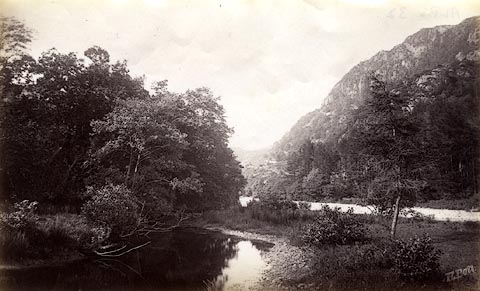 click to enlarge click to enlargeHB0378.jpg item:- Armitt Library : ALPS32 Image © see bottom of page |
|
|
|
||
 Lakes Guides menu.