 Old Cumbria Gazetteer
 |
 |
|
| Windmill, Bromfield | ||
| locality:- | Langrigg | |
| civil parish:- | Bromfield (formerly Cumberland) | |
| county:- | Cumbria | |
| locality type:- | windmill | |
| locality type:- | tower mill | |
| coordinates:- | NY16904546 | |
| 1Km square:- | NY1645 | |
| 10Km square:- | NY14 | |
| references:- | Listed Buildings 2010 |
|
|
|
||
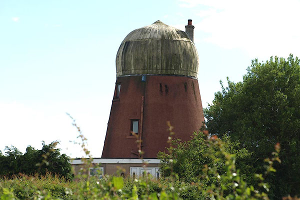 BPI39.jpg (taken 14.6.2008) |
||
|
|
||
| evidence:- | old map:- OS County Series (Cmd 28 14) placename:- Langrigg Mill |
|
| source data:- | Maps, County Series maps of Great Britain, scales 6 and 25
inches to 1 mile, published by the Ordnance Survey, Southampton,
Hampshire, from about 1863 to 1948. "Langrigg Mill (Corn)" |
|
|
|
||
| evidence:- | database:- Listed Buildings 2010 placename:- Windmill, The |
|
| source data:- | courtesy of English Heritage "THE WINDMILL / / / BROMFIELD / ALLERDALE / CUMBRIA / II / 411234 / NY1690645466" |
|
|
|
||
 Lakes Guides menu.