 Old Cumbria Gazetteer
 |
 |
|
| Whitehaven: Church Street | ||
| Church Street | ||
| civil parish:- | Whitehaven (formerly Cumberland) | |
| county:- | Cumbria | |
| locality type:- | buildings | |
| coordinates:- | NX97311808 | |
| 1Km square:- | NX9718 | |
| 10Km square:- | NX91 | |
| references:- | Listed Buildings 2010 |
|
|
|
||
| evidence:- | old map:- OS County Series (Cmd 67 2) placename:- Church Street |
|
| source data:- | Maps, County Series maps of Great Britain, scales 6 and 25
inches to 1 mile, published by the Ordnance Survey, Southampton,
Hampshire, from about 1863 to 1948. |
|
|
|
||
| evidence:- | old map:- Donald 1774 (Cmd) placename:- Church Street |
|
| source data:- | Map, hand coloured engraving, 3x2 sheets, The County of Cumberland, scale about 1
inch to 1 mile, by Thomas Donald, engraved and published by Joseph Hodskinson, 29
Arundel Street, Strand, London, 1774.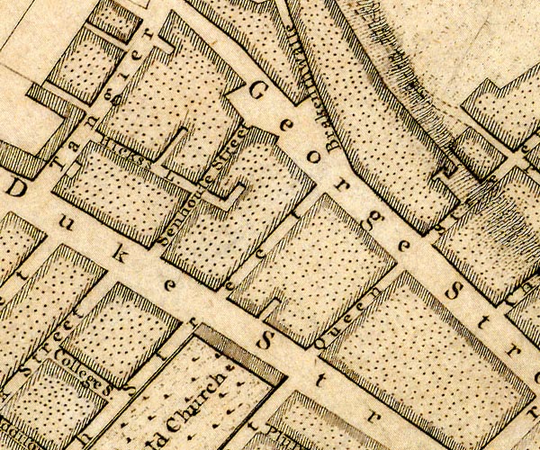 D49718L.jpg 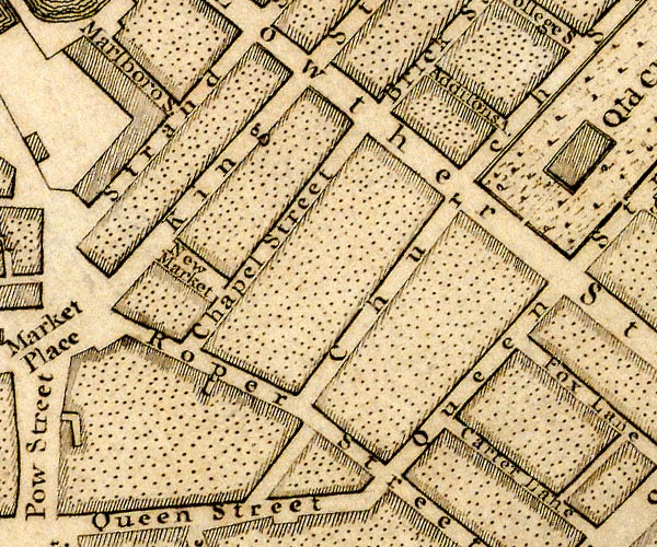 D49718F.jpg "Church Street" street item:- Carlisle Library : Map 2 Images © Carlisle Library |
|
|
|
||
| evidence:- | database:- Listed Buildings 2010 |
|
| source data:- | courtesy of English Heritage "/ 41275 / CHURCH STREET / WHITEHAVEN / COPELAND / CUMBRIA / II / 75907 / NX9731418084" |
|
|
|
||
 Lakes Guides menu.