 Old Cumbria Gazetteer
 |
 |
|
| Warcop Tower, Warcop | ||
| Warcop Tower | ||
| locality:- | Warcop | |
| civil parish:- | Warcop (formerly Westmorland) | |
| county:- | Cumbria | |
| locality type:- | buildings | |
| coordinates:- | NY74501516 | |
| 1Km square:- | NY7415 | |
| 10Km square:- | NY71 | |
| references:- | Listed Buildings 2010 |
|
|
|
||
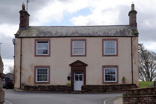 CAH34.jpg (taken 11.4.2014) |
||
|
|
||
| evidence:- | old map:- OS County Series (Wmd 16 13) placename:- Warcop Tower |
|
| source data:- | Maps, County Series maps of Great Britain, scales 6 and 25
inches to 1 mile, published by the Ordnance Survey, Southampton,
Hampshire, from about 1863 to 1948. "Warcop Tower / (Site of Manor House)" |
|
|
|
||
| evidence:- | database:- Listed Buildings 2010 placename:- Warcop Tower item:- date stone (1784) |
|
| source data:- | courtesy of English Heritage "WARCOP TOWER AND FARMHOUSE / / / WARCOP / EDEN / CUMBRIA / II / 73406 / NY7450715164" |
|
|
|
||
| evidence:- | database:- Listed Buildings 2010 item:- date stone |
|
| source data:- | courtesy of English Heritage "THRESHING BARN TO NORTH- EAST OF WARCOP TOWER FARMHOUSE / / / WARCOP / EDEN / CUMBRIA / II / 73407 / NY7452115194" |
|
|
|
||
| evidence:- | database:- Listed Buildings 2010 |
|
| source data:- | courtesy of English Heritage "WALLS, GATE, AND END PIERS TO NORTH OF WARCOP TOWER / / / WARCOP / EDEN / CUMBRIA / II / 73409 / NY7450415203" |
|
|
|
||
| evidence:- | database:- Listed Buildings 2010 item:- date stone |
|
| source data:- | courtesy of English Heritage "RAMP BARN AND BYRES TO NORTH-WEST OF WARCOP TOWER FARMHOUSE / / / WARCOP / EDEN / CUMBRIA / II / 73408 / NY7449215197" |
|
|
|
||
| notes:- |
site of a tower |
|
| Perriam, D R &Robinson, J: 1998: Medieval Fortified Buildings of Cumbria: CWAAS::
ISBN 1 873124 23 6 |
||
|
|
||
 Lakes Guides menu.