 Old Cumbria Gazetteer
 |
 |
|
| Stone Hall, Sedbergh | ||
| Stone Hall | ||
| Street:- | Stonehall Lane | |
| civil parish:- | Sedbergh (formerly Yorkshire) | |
| county:- | Cumbria | |
| locality type:- | buildings | |
| coordinates:- | SD67179278 | |
| 1Km square:- | SD6792 | |
| 10Km square:- | SD69 | |
| references:- | Listed Buildings 2010 |
|
|
|
||
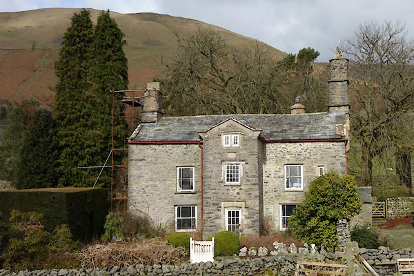 CCP17.jpg (taken 10.3.2015) 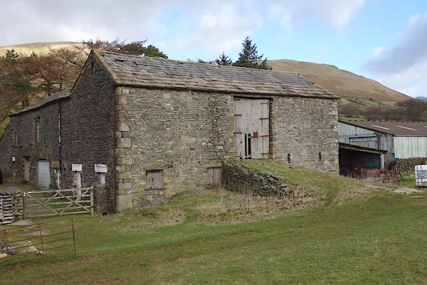 CCP18.jpg Barn. (taken 10.3.2015) |
||
|
|
||
| evidence:- | old map:- Jefferys 1770 (Wmd) placename:- Stone Hall |
|
| source data:- | Map, 4 sheets, The County of Westmoreland, scale 1 inch to 1
mile, surveyed 1768, and engraved and published by Thomas
Jefferys, London, 1770.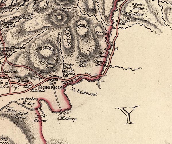 J5SD69SE.jpg "Stone Hall" circle, labelled in italic lowercase text; settlement, farm, house, or hamlet? item:- National Library of Scotland : EME.s.47 Image © National Library of Scotland |
|
|
|
||
| evidence:- | old map:- Cary 1789 (edn 1805) placename:- Stone Hall |
|
| source data:- | Map, uncoloured engraving, Westmoreland, scale about 2.5 miles
to 1 inch, by John Cary, London, 1789; edition 1805.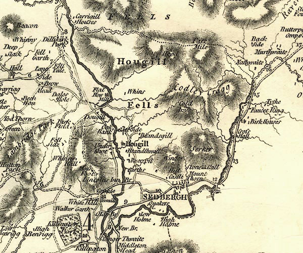 CY24SD69.jpg "Stone Hall" house symbol; large house item:- JandMN : 129 Image © see bottom of page |
|
|
|
||
| evidence:- | old print:- Thompson 1894 placename:- Stone Hall |
|
| source data:- | Print, engraving, Stone Hall, Sedbergh, Yorkshire, published by Richard Jackson, Commercial
Street, Leeds, Yorkshire, 1894.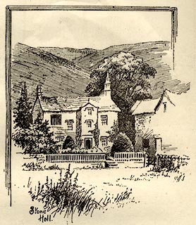 click to enlarge click to enlargeTHP121.jpg On p.90 of An Illustrated Guide to Sedbergh, Garsdale, and Dent, by W Thompson. item:- Armitt Library : A1612.B21 Image © see bottom of page |
|
|
|
||
| evidence:- | database:- Listed Buildings 2010 placename:- Stone Hall item:- date stone (1695) |
|
| source data:- | courtesy of English Heritage "STONE HALL / / STONEHALL LANE / SEDBERGH / SOUTH LAKELAND / CUMBRIA / II[star] / 484652 / SD6717292786" |
|
|
|
||
| notes:- |
site of a group of early stone houses |
|
| Perriam, D R &Robinson, J: 1998: Medieval Fortified Buildings of Cumbria: CWAAS::
ISBN 1 873124 23 6; illustration |
||
|
|
||
 Lakes Guides menu.